Geoporter – One community…An educator…And maps that make a difference
Reply
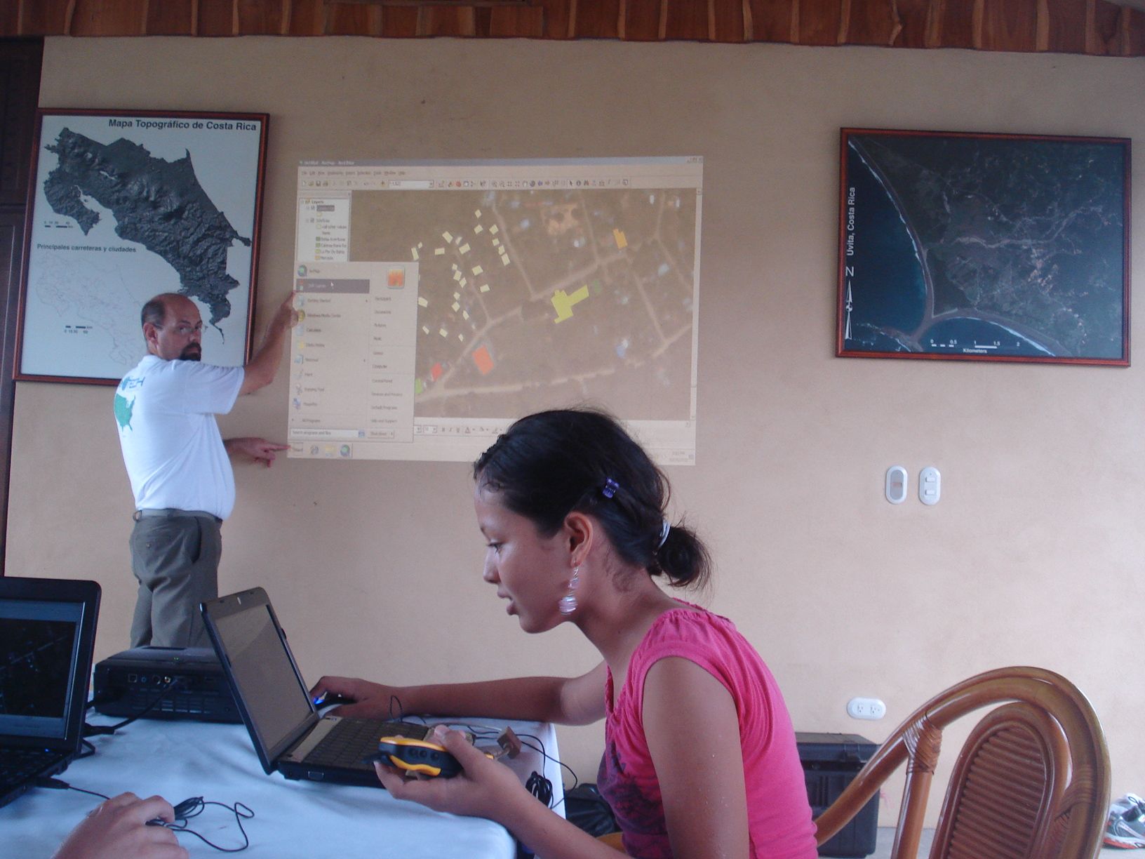 So who is that amazing young woman in the picture above? Her name is Maria Paula and she is a fourteen year old Costa Rican student who has been captivated by GIS, GPS and its uses in her community. She is the expert of her small tourist community in mapping the trash and is using that data to help figure out ways to solve that important environmental issue. When Maria Paula was just thirteen, she gave a stunning talk on this topic to 700 GIS professionals at the Latin American GIS Conference in the fall of 2011. Please view the short video for a glimpse of the slide show and amazing talk that Maria Paula presented.
So why does GISetc care about this story? As some of you may know, Roger and I are principals of GISetc and have been traveling to Uvita-Bahia Ballena, Costa Rica over the past three years. Roger, our friend Charlie and I have been providing training to community members in the use of geospatial technologies (Esri GIS desktop and online software, GPS, remote sensing) to solve community issues. GISetc has fallen in love with the residents of Bahia Ballena and the area and are so impressed by their hard work and dedication to the environment and to each other. In response to a request from the community, GISetc is pleased to announce the inauguration of a program entitled GEOPORT (Geospatial Educators Opportunities for Partnership, Outreach, Research, and Training).
We are all looking forward to providing lots of video, images and interesting blog content on this website so come back often. Will you also perhaps consider partnering with GEOPORT and the residents of Uvita-Bahia Ballena? It will be great fun and a perfect way to connect with an international community! The GEOPORTer project is funded primarily by donations. We have some great sponsorship appreciation gifts and the opportunity to interact with the Amy Work, the first GEOPORTer while she is deployed. No amount is too small. Please share this with your family and friends. GEOPORT is a project where everybody wins!
Anita & Roger Palmer GISetc
P.S. Oh yes, by the way, please LIKE GEOPORTers on Facebook and follow GEOPORTers on Twitter.
We had our first GPS and GIS training of the week at Escuela Verde. While the students were on their two week break, a few of the teachers came back to school to see what GPS is all about and get some ideas on how they can use it in their classes. Escuela Verde is a bilingual school, offering classes in both Spanish and English for students in K-6. Some teachers were very comfortable in English, while others were native Spanish speakers with limited English. But when teaching others to use GIS and GPS, its seems that it has its own language that is universal.


We started off with an overview of ArcGIS.com, demonstrating how to access a variety of basemaps and other data hosted online. One teacher, David, picked up on using the ArcGIS online immediately and had set up an account and was on his way just after the overview. It was so great to see him and the others dive right in. After some exploring on the computers we stepped outside to use the GPS units.

The best way to learn how to use a GPS unit, start using the unit as you walk around the school building looking at your track and collecting waypoints. There are also several great activities that explore latitude and longitude, as well as finding your location from the Going Places with GPS book.


Over the next month, the teachers have been asked to explore some more with the online GIS and the GPS units so that when I’m back in August I can help them answer any questions they might have as well as help them with their ideas on integrating both into their teaching.

A brief stroll down the newly paved road in Bahia Ballena took us to the entrance of Parque Nacional Marino Ballena. Stopping to pick up towels along the way, we were all set to head to the beach. I must say, it was simply amazing. The water was like bath water, the backdrop of the beach were palms and forest, and blue sky’s were plentiful.
After some time at the beach, we made our way back to our hotel, La Fiore de Bahia, to cut up some piña, and make guacamole. This afternoon we met with a few people, Travis, Rafa, Ronald, y Ray, who we will be working with this time and when I come back in August. We also planned out our itinerary for the week which includes a visit to Escuela Verde to do some GPS training with the teachers, going out on a boat tour with Rafa from Bahia Aventures to get a better understanding of the whale monitoring the tour boat operators wish to do, a meeting with a few of the local boat tour guides, meeting with the KETO foundation to see what program they are working for monitoring whales, and a few other activities before we head back to San Jose Thursday.


