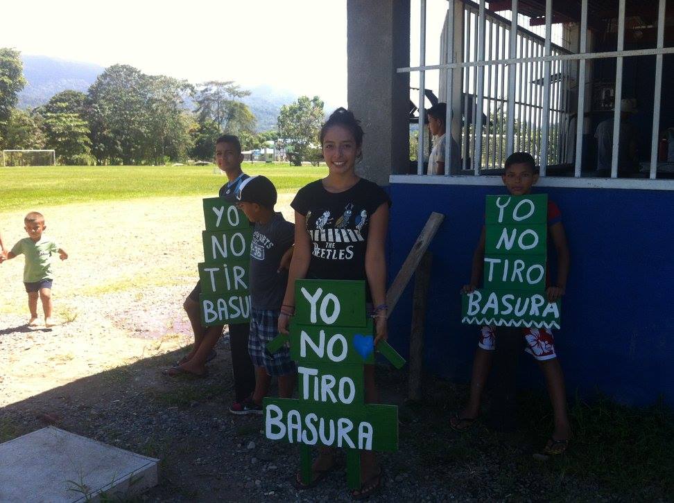
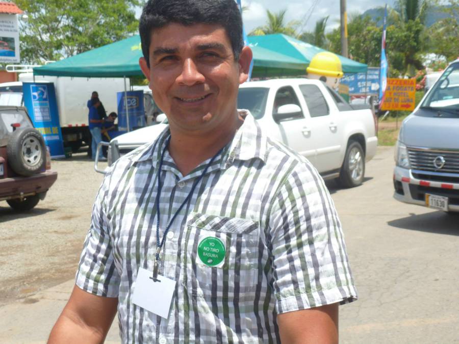
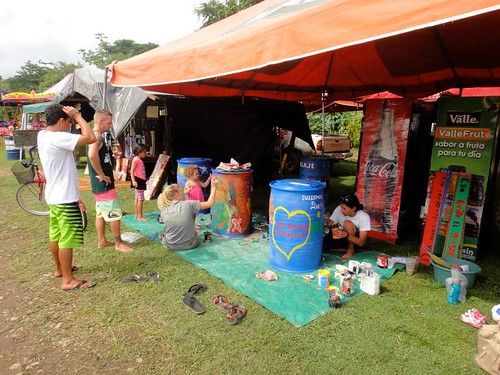
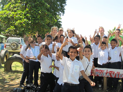
January, we celebrated World Environmental Education Day. We celebrated this day with our friends and colleagues from Bodhi Surf, Bahia Aventuras, Hotel Bahia Azul, ASOGUIBA and others. Youth and adults alike participated in a street cleanup, trashcan clean-out, and sign painting and placement. The signs were an expansion of the “Yo No Tiro Basura” sticker campaign that was established during the Festival of Whales and Dolphins. We topped it all off with an amazing lunch of “arroz con pollo” or rice and chicken, were almost everyone brought their own eating utensils.
It’s time for an “Organización sin fines de lucro”
Geoporter community members have been working hard these first two months starting the process and paperwork to obtain a non-profit status in Costa Rica, or what is known as an Organización sin fines de lucro. This status will provide Geoporter with additional opportunities.
Additionally, community members have identified the projects and goals they wish to accomplish during 2015. We’re taking the leap from three community based projects to six. The projects include:
Clean Streets, Clean Waters
Participatory Whale Monitoring
Coastal Escuelas
Aguas Grises / Aguas Contaminadas (new)
Coastal Reforestation (new)
Flaura / Fauna (new)
Always in our hearts
Bahia Ballena experienced a huge loss at the beginning of 2015. One of Geoporter’s key supporters, Walter Brenes, and owner of Bahia Aventuras, was taken from us all too quickly, along with two other colleagues Cezar Fonseca and Daljit Singh of Bahia Aventuras. The community is still recovering, taking one step at a time and continuing to keep these individuals in our hearts as the sun rises each day without them. Here is a wonderful piece highlighting the our dear friend Walter from our colleagues at Bodhi Surf.
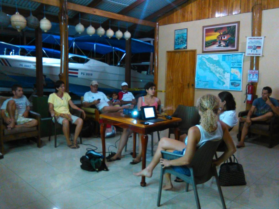
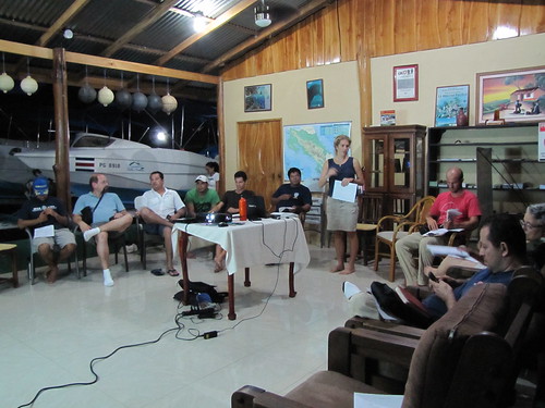
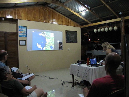
In late May we will be having our annual in-person Board of Directors meeting. What are other organizations doing that Geoporter should be aware of that can help us to continue to grow and improve? We are still young and have room to learn from all of you. If you know of something, we’d love to hear from you.
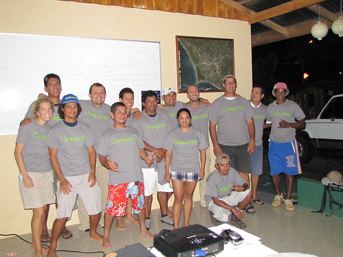
August 7, 2012, I was making my way to Bahia Ballena to spend 2 months training residents, youth and teachers how to use GIS and GPS to map the whale sightings, trash in the community and use in the classrooms. Here we are 12 months later celebrating our first year as Geoporter and 1 full year in Bahia Ballena. What a year it has been.
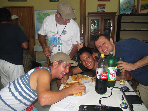
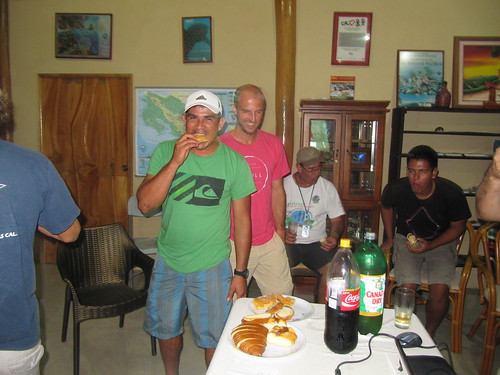
I had the opportunity to spend the 1-year anniversary with two of the co-founders, Anita and Roger Palmer from GISetc and a project supporter here in Bahia Ballena alongside all the community partners. What did we do? We held a community advisory meeting to assess our current progress and chart out where we want to go. We created commissions and assigned individuals to assist with various projects. We celebrated with “arroz con pollo”…and with new t-shirts that were generously donated to the project.
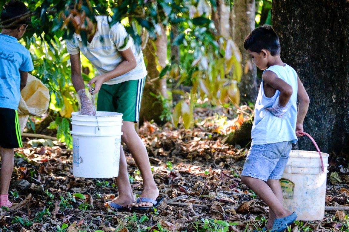
It’s incredible to think how far we have come over the course of one year. But as we review this, there is still so much to do. New projects continue to develop and evolve weekly. For example, a new project is recording the locations of dead animals along the Costanera between Dominical and Playa Tortuga. We have also had success in placing new trash-cans around the community along with painting new trash cans to place in new locations identified using the trash map generated by the community. We have a separate trash-committee that is working to take steps towards preventing trash from entering the streets of Bahia, which will ultimately reduce the amount of trash we see in our oceans.
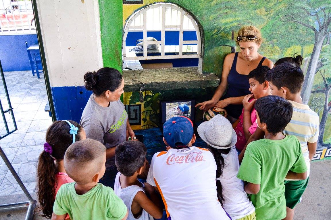
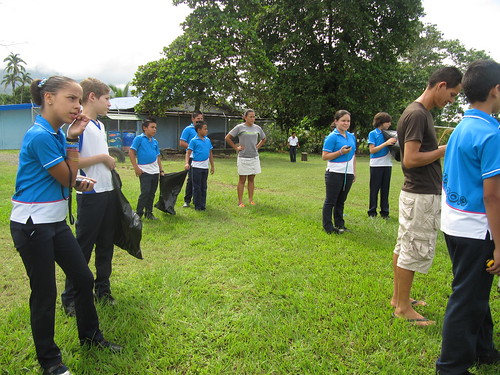
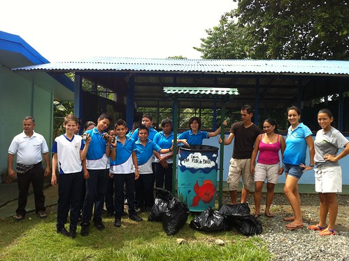
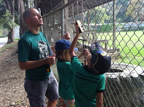
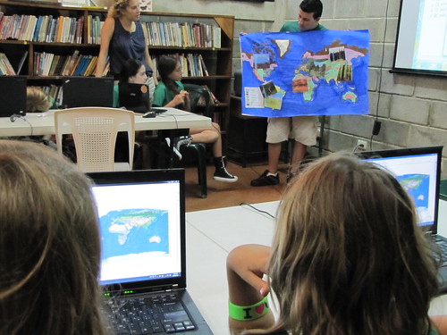
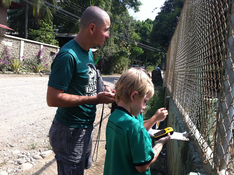
We have also connected with the elementary school here in town, Escuela la Flor de Bahia, to work with the teachers and students on mapping trash. Once a week a group of five community members heads to the school to use GPS to map and record the trash around the school and soccer field. It’s incredible to see how quickly the students are picking up on the GPS technology and racing to mark the next piece of trash. This trash mapping supports one of the activities the school has identified for their participation in the Bandera Azul program.
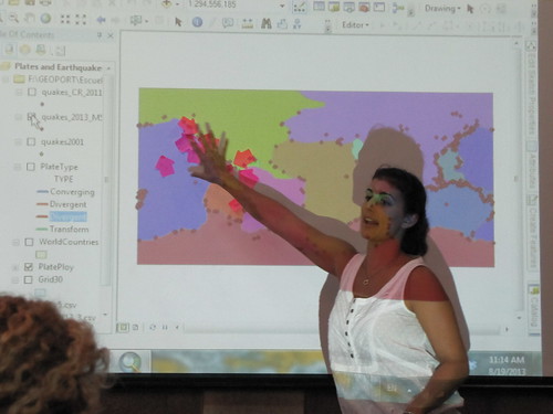
At Escuela Verde, there are four teachers using GIS and GPS with their students. They are using the technologies to understand soil types, boundary limits of their community, doing math geocaching, exploring ancient civilizations such at the Egyptians, Mayans or Nazcas, or understanding what causes earthquakes and where they occur (outside of Costa Rica). The students, ranging from grades 2-6, are now asking, “when’s the next time we get to use GIS again Miss. Amy.”
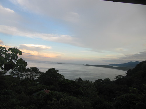
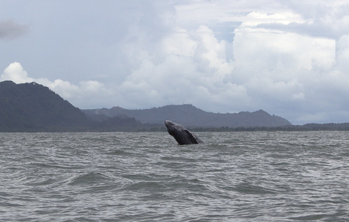
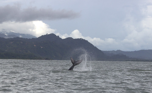
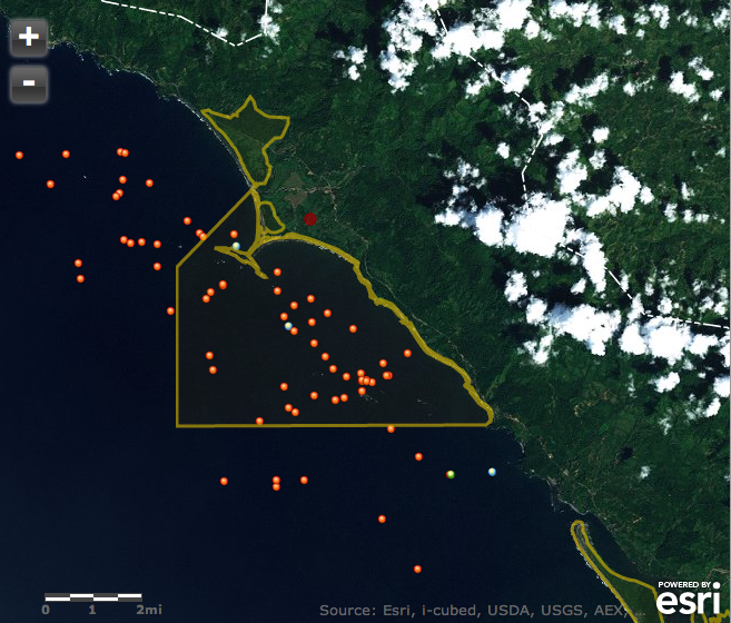
Currently we are in the middle of the 5th Festival of Whales and Dolphins, which brings people from all over the world to celebrate the Southern Humpback whales that call Marino Ballena Park home for approximately 5 months of the year. The 8 guides and captains and 3 companies participating weekly in this season’s monitoring, are busy taking guests out to the park to see the whales jumping. The whales are plentiful and at times the boats will see 8 whales. The most exciting news was seeing orca’s near Isla Cano and 4 male humpback whales jumping trying to gain the attention of a female humpback whale. And of course seeing the humpback whales jumping out of the water and showing us their tales (which are both white and black from the southern migrations).
Since August of 2012, I have been living and working in Bahia Ballena, Costa Rica teaching and training educators, youth and community members how to use geospatial technologies, or GIS and GPS, to investigate their community resources or issues they think are important. I want to take just a few minutes to summarize some of the incredible Geoporter activities taking place here in this wonderful community that have occurred in the past month. There are so many things, but I’ll try to keep it short.
Pollination Project
Geoporters was selected as a recipient of a Pollination Project to improve our mobile geospatial technology lab. With their support we were able to secure a few additional GPS units, one that have a stronger signal under the forest canopy cover, two laptops to conduct additional GIS trainings, and rechargeable batteries to use with the GPS units. We are so happy to be a part of this wonderful opportunity. We have also been asked to help another Pollination Project to use geospatial technologies to map the trees they are planting. What a great example of being able to thank The Pollination Project by “paying it forward.”
Let’s talk about Boundaries and Mountains at Escuela Verde:
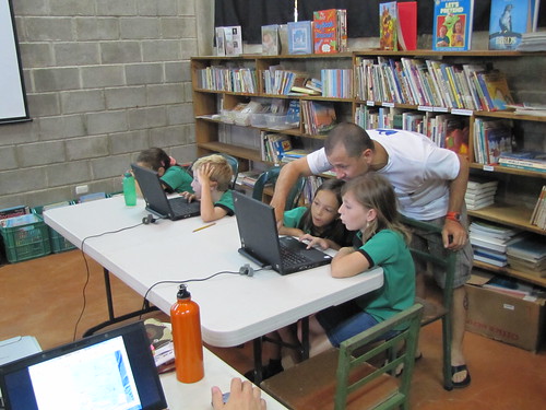
I’ve had the opportunity to work with incredible teachers and staff at Escuela Verde, a bi-lingual school for grades K-6. To see the way these students are processing the information related to the GPS and GIS activities they are doing, is incredible. The past few weeks I have been working closely with Esteban, the new 5/6th grade science teacher and David, the 1st/2nd grade social studies.
David’s students are learning about political boundaries and key features found in every Costa Rican town; which include a soccer field (cancha), mini-supermarket (pulpería), church (iglesia), and school (escuela). To make learning these concepts more fun, we took a field trip to actually see the boundaries of the district, Costa Ballena, where the school is located. We marked the locations of the boundary limits and the features using GPS units. Oh, and don’t forget about the photos to go along with GPS’ing the locations.
The class is now downloading the waypoints and photos, and transferring the information that was recorded on paper to a digital version so we can symbolize the features to create a map to share with their parents.
Esteban’s 5/6th grade class has been exploring mountains, valleys, rivers and deserts that are found in Costa Rica and around the world (with deserts in the world rather than Costa Rica). What is the tallest mountain in the world? What is the largest desert in the world? The longest river? And where are all of these features located?
After examining a map of these features using ArcGIS Desktop and a modified activity from Mapping Our World, we used GPS units to mark elevations on school grounds. The students were able to compare mountains, valleys and rivers found on the map, but understanding differences in elevation. Next students are planning to create presentations highlighting these features and more information about each theme.
What to do when the northern whales have started their migration north?
The whale monitoring project working with tour guides, captains and tour companies has taken somewhat of a break this month due to the early departure of the northern whales that have called Bahia Ballena home since late October. But this has provided us the opportunity to prepare for the southern whale migration season, which will arrive in June and stay through early November.
We are in the process of mapping the whale sighting data from this past season of northern whales to add to the map of the southern 2012 whale season from August to October. We will then be able to use these maps when we start our training for new guides and captains next week.
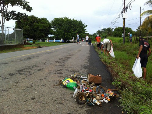
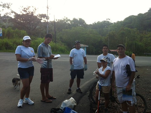
Rise and shine!!! It’s Trash Collection Time!!
Starting in April, a solid group of about 8 people (at times up to 15 people) have collected and categorized trash in order to map the landscape of trash in the streets and on the beaches of Bahia Ballena. We’ve had 5 trash collections starting at 6 am. Yep, that’s 6 am. The sun has just come up and it’s one of the coolest times of the day. We’ll collect trash until 8 am, but it seems that we have such a great group that we don’t finish until around 9 am. And one day, we went until 10 am when the sun and heat let us know that it was time to call it a day.
We’ll continue to map the trash in the streets to continue providing information for others, Asociacion de Guias de Bahia Ballena (ASOGUIBA), Asociacion de Tour Operadores, and the Asociacion de Desarrollo (Development) can construct new trash cans and place them in the areas of trash hotspots.
Silence your cell phones, it’s presentation time
On May 7th, Geoporter had the opportunity to present our project and what we are doing to the Chamber of Tourism and Commerce of Costa Ballena de Osa (CACOBA). We presented all the projects we have been working on and a future project of creating a community map of Bahia Ballena with youth here in town. We’ve already made some progress with getting some of the waypoints and photos of different tour companies, restaurants, hotels in town.
We were also invited to a meeting organized by KETO to present our trash mapping project as they continue to work with different individuals, organizations and the National Park staff to seek improvements for Marino Ballena National Park.
This week, we will be driving to San Jose to make a presentation to La Nacion, a national newspaper in Costa Rica. In the afternoon we are headed over to meet with MarViva, an organization that promotes the conservation and sustainable use of coastal and marine ecosystems in the Eastern Tropical Pacific.