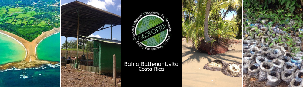
Costa Rica
BRIDGING THE CONTINENTS WHILE SPANNING THE GEOSPATIAL DIVIDE
The first project location of Bahia Ballena-Uvita, Costa Rica, fit perfectly the mission and vision of Geoporter. This project builds capacity to assist in the community transition the community from farming and fishing to tourism through support of managing its own sustainable growth.
Bahia Ballena-Uvita is a southern Pacific coastal town of approximately 3000 people just north of the Osa Peninsula in Costa Rica. The main economy has historically been farming and fishing but over the past 20 years, the community has transitioned to marine based tourism. The Bahia Ballena shoreline is the eastern (coastal) boundary of Marino Ballena National Park, the first marine park and fourth most visited national park of Costa Rica. It is the nexus for both the northern and southern whale migrations, creating both a tremendous tourism economic potential while creating stress on the community and environment if not properly managed. Not only does Costa Rica bridge two continents, but this project is helping to bridge people’s understanding of the Bahia Ballena community through the use of geospatial technologies.
WHY BAHIA BALLENA, COSTA RICA?
Upon suggestion of a colleague involved in educational travel, GISetc traveled to Bahia Ballena-Uvita to meet community members Geinier Guzman from La Cusinga EcoLodge and Travis Bays from Bodhi Surf and GRUPO Surf. These two community visionaries connected us with multiple groups and schools in the area to expose them to geospatial technologies. Since 2009, leaders from GISetc made a dozen trips to Bahia Ballena to work with the community to understand the uses of geospatial technologies as they navigate the waters of sustainable tourism. In this rural area, community members have an intimate understanding of the environment in which they live. They are quickly aware of migrational changes of land and sea animals, but limited in knowing regional, national or global factors that may bring on these changes. The introduction of geospatial technologies since 2009 has begun to clarify external and internal factors in this communities development. In March of 2012, the community requested assistance solidifying its geospatial methodologies to carry out two self-identified projects: trash mapping and whale monitoring.
In August 2012, Geoporter sent Amy Work, our first geospatial educator, to Bahia Ballena-Uvita for a sustained eight week period. She provided education and assistance to school teachers and youth, boat tour operators, and community members at large in refining their use of geospatial technologies in their projects.
Following the initial 2 months, it was collectively decided by all parties to move forward with Geoporter and continue to assist educators, organizations, and community members to use and apply geospatial technologies to existing projects and new project. The Geoporter resides in Bahia Ballena with GISetc staff return periodically to Bahia Ballena-Uvita to follow-up with the community members to ensure the progress of Geoporter and the community projects. The Bahia Ballena project is monitored quarterly and has periods of the year where the geospatial educator leaves, allowing evaluation of the progress of Geoporter and the implementation of geospatial technologies into new projects. In addition to Bahia Ballena, Geoporter is supporting other communities around the world integrate geospatial technologies. Please contact us if you wish to learn more about Geoporter in your community.