As mentioned earlier, one of the projects I’ll be working on while I’m here Uvita – Bahia Ballena is mapping the basura (trash). The first day I arrived, I wanted to get to know my way around town a little better. I figured what better way to get to know the town than to walk around while also getting a closer look at one of the projects I’ll be working on. I could have ventured by myself, but then what fun would that be. Maria Paula was out of school for the week (think more like a spring break for students in the U.S). so she came with me. For this first venture, we walked through town and then along la playa Chaman. For this adventure we took two GPS’s. We found several other items of interest besides trash.


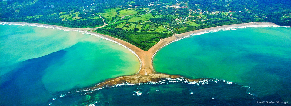
On our next outing the following day, Maria Paula and I stopped to pick up her friend and classmate Suhel. This time we had 3 GPS’s and a plastic bag to collect trash in. When we reached the park entrance, the park rangers let us in without having to pay the $6 that’s typically required to access the Marino Ballena National Park. We ventured in the opposite direction towards the Tombolo, or the part of the beach that look’s like a whale’s tale. This tombolo is a natural formation.
Shortly after we ventured down the beach, we realized that the bag we brought with us to collect the trash was too small. We made too and eventually wound us using our hands to take the trash out with us. It’s amazing the type of basura you’ll find on the beach. These are some of the most beautiful beaches I’ve seen. So where does this trash come from that ends up on the beach? Well that’s one of the questions we hope that using GPS and GIS will help us to understand.


