Ten things I learned volunterning with Geoporter…

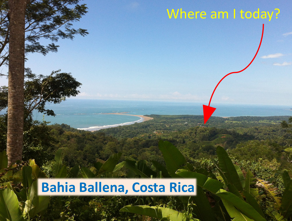
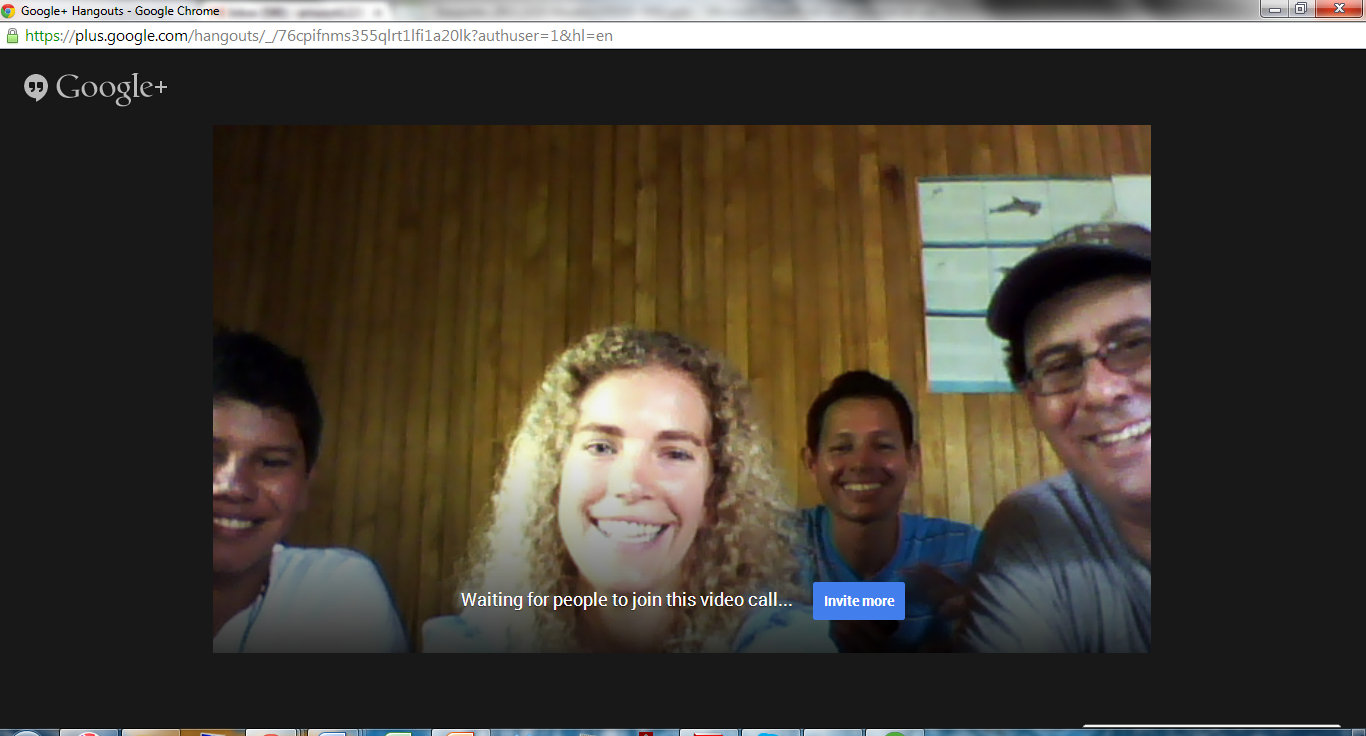
Last year Lucy visited Bahia Ballena to get involved with Geoporter. She shares what she learned in her time with us.

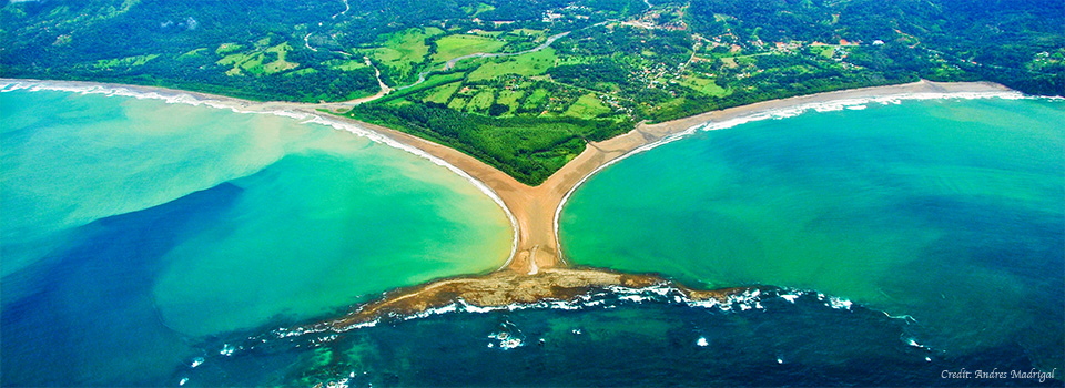
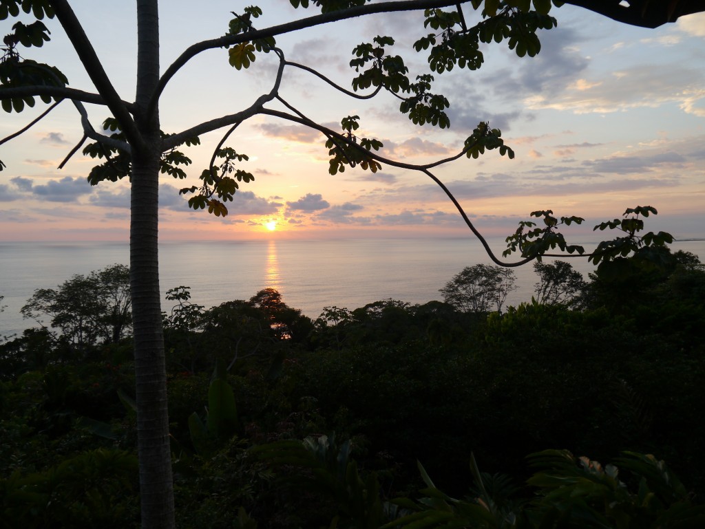
  1. Costa Rica is one of the most incredible countries in the world. Don’t believe me? Browse Geoporter’s flickr for just a few moments to appreciate the incredible diversity of plant and animal life, the friendly and open nature of Ticos and Tica’s alike, and the awe inspiring weather, from rainstorms to breath-taking sunsets.

P1070607

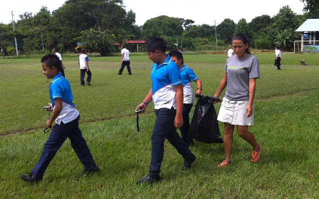
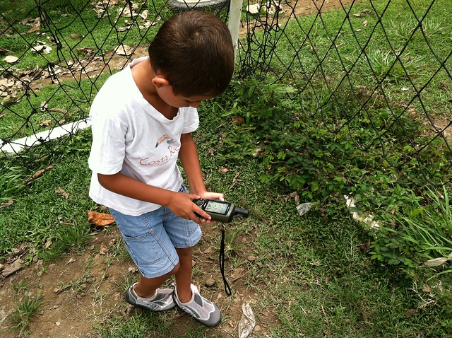
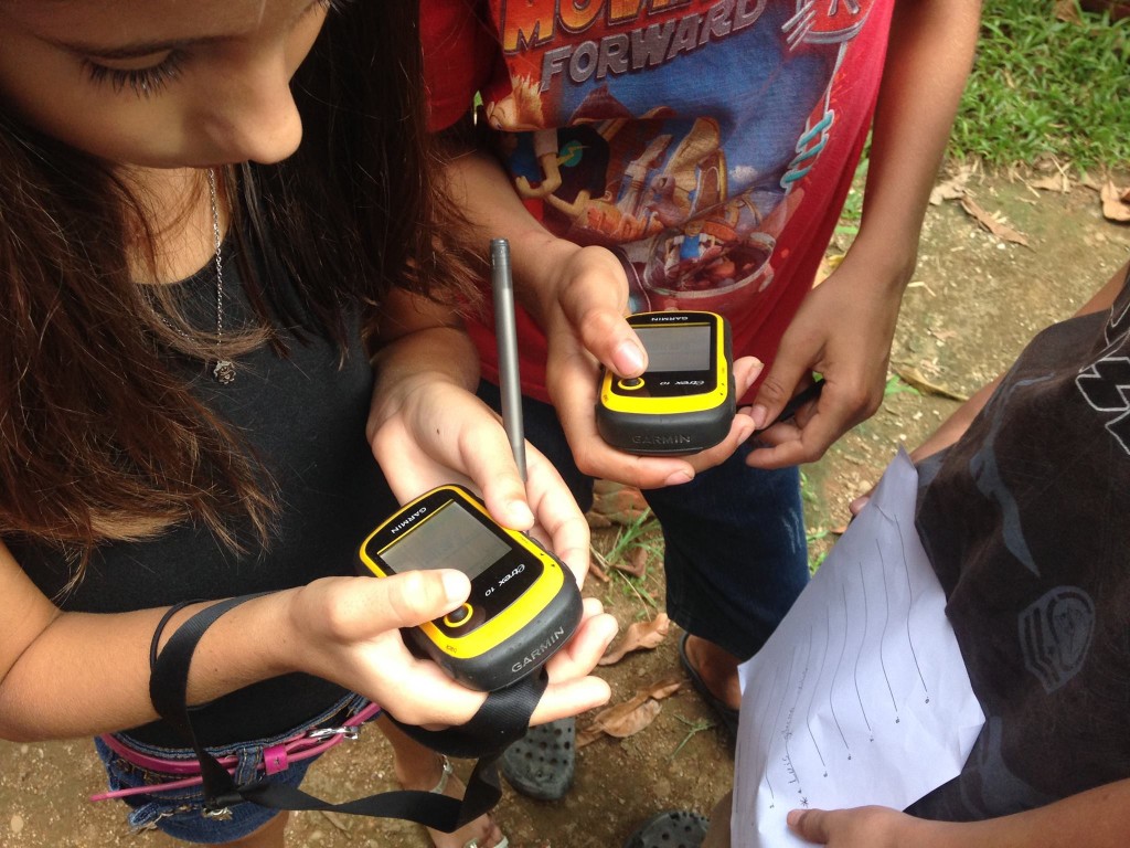
  1. Kids are fun! An afternoon geocaching with the young people that attend Forjando Alas youth group was amazing. Their enthusiasm to learn more about GPS technology and their energy to apply their knowledge RIGHT AWAY is infectious! Plus, it’s smiles all round when they answer the quiz questions you came up with correctly! 1498025_916501508433644_2134112300767272216_o
  1. We all have more to teach each other than we realise. Skills you might take for granted in yourself can be seen as incredibly valuable by another. Turns out, knowing how Facebook works and its little quirks is actually pretty handy to Geoporter and the growing businesses of Bahia Ballena.
  1. A GPS isn’t a compass (or an iPhone on map mode!). Note to self – spinning gets you nowhere!
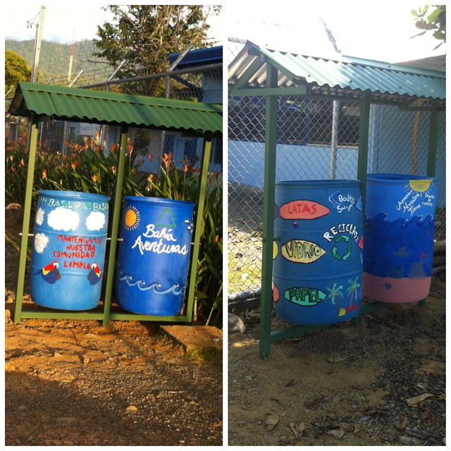
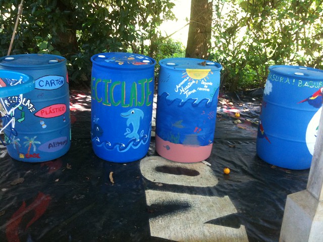
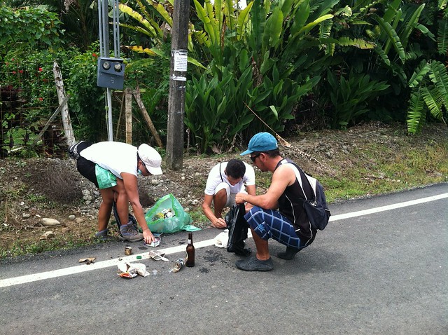
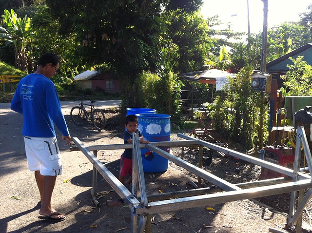
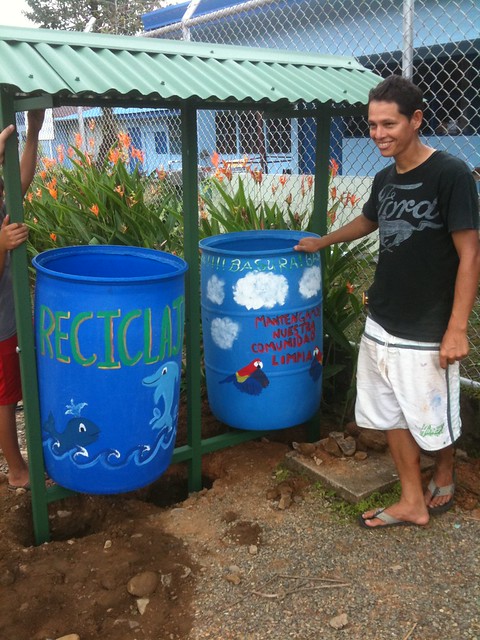
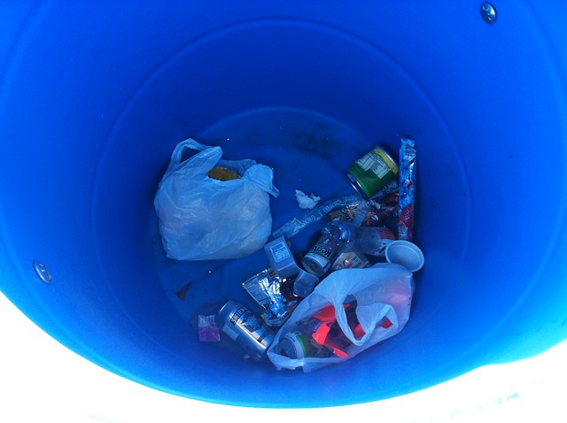
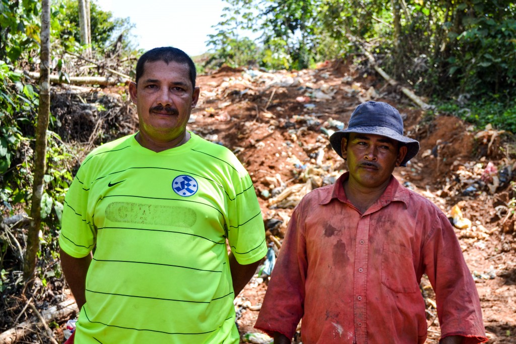
  1. No matter where you are in the world, rubbish is still a sad reality of life. It has the potential to ruin paradise unless we take action. Luckily, Geoporter and the folks of Bahia Ballena are on the case.

23807471276_db66b0f0b7_o

  1. Learning a new language is HARD. But learning it is fun, especially when you get words mixed up! And when you finally start to get there – it’s so rewarding!
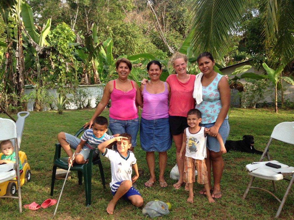
  1. Language is never a barrier to friendship. I will be eternally grateful to Flor for taking me into her home for a month, and to the (seemingly never ending!) stream of her family members who became my friends and helped me feel welcome in Bahia Ballena.

23556006114_50511751e6_o

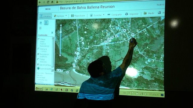
  1. GIS can generate more questions than answers! Geoporter has been on an incredible journey, mapping the trash of Bahia Ballena. Brilliant actions have been taken as a result of these maps, and the community continue to educate themselves about their waste. But, studying the maps always leaves new questions to be answered – what happens to the trash once it leaves the community? Are we sending the right type of trash to be recycled? Asking questions is vital to educate ourselves about the impact we have on the world around us, and Geoporter continues to do that.
  1. Water is an incredibly precious resource. We all know this of course, but living for a month in a community that’s developing rapidly and is working with Geoporter to map its water sources brought home just how vital it is that this resource is secured for all in the future.
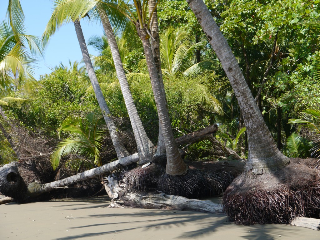
  1. Sea levels are rising. Whilst millions of us already know this, coming face to face with the reality of rising tides in Bahia Ballena was shocking. Trees are being eaten up at an alarming rate, leaving beaches and wildlife without protection. Thankfully, Geoporter and the community of Bahia Ballena are taking steps to mitigate this, but the question still stands – will we still have coastal rainforests in ten years time?

24969442081_c25eaa2da0_o

Volunterns from around the world spend months with Geoporter

The impact a volunteer provides to an organization is difficult to measure. It is not the number of hours worked, but rather the values shared and lessons learned from both the organization and the volunteer that are so important. Geoporter has been extremely fortunate to collaborate with some incredible volunteers.

Since our inception, Geoporter has had three official interns, or what we call volunterns. The position is volunteer based but also designed similar to an internship. In addition to the three volunterns, a few Bodhi Surf interns spent some time assisting us as well. The work of these individuals has helped contribute to the success of Geoporter. We would not be where we are without the support of these individuals.

Maggy Wenzlau, from Stanford University, was our first volunteer. She helped create and examine the Clean Streets, Clean Waters data. Fiona Lewis came from Australia during her “gap” year and was so committed to the project that she returned for a second visit! Fiona helped train community members on social media and also gathered information and documentation for future volunteers. Christian Gehrke was our most recent volunteer. He spent time in July and August collecting aerial imagery of Bahia Ballena using a drone on loan from Ohio Wesleyan University.  

ChristianFionaMaggy.jpg

From Bodhi Surf, Ruben Minnema, from Holland, helped Geoporter pull together our first year-in-review report. Melissa Rejeb, from Brussels, helped capture some amazing photographs of various Geoporter events, and Erin Robinson, from Deloitte and Touche, helped us create budgets for future years.

Each of these individuals has moved on to other opportunities, but their impact on Geoporter endures. We look forward to the arrival of Lucy Bell-Reeves from London in mid November to assist with our marketing efforts.  

Geoporter and a Graduate: The Buzz About Christian

I’m Christian Gehrke, a recent graduate of Ohio Wesleyan University (OWU) from San Mateo, California. I am down here in Costa Rica to both be a sort of liason between Geoporter and OWU, but also volunteer for Geoporter and help the community of Bahia Ballena until the end of August.

Now how did I get here, you may ask? Well, the answer is basically a mix of luck and right timing…and I suppose a little bit of skill on my part. I frankly need to rely on that skill, since before coming to Costa Rica, I was able to speak about five words of Spanish. But, I’ll have you know, I’ve been down here for over three weeks now, and I can confidently say that I know almost 16 words at this point, and counting – I know, I’m a fast learner. The people have been very understanding and patient with me, which I cannot thank them enough for.

One of the ways I distract the locals from my complete ineptitude in learning and retaining their language is with one of the instruments that I came down with, which is a drone with an attached camera. One of my tasks while I am down here is help update the aerial imagery of the area, mostly Bahia Ballena, which hasn’t been properly updated since 2001. This is helpful for Geoporter in terms of mapmaking, analysis, reference, and more. It’s also fun for me to see the reactions of some people when they see it fly.

The cool thing about this drone is that you can control the angle of the camera while it’s flying, so after I have captured the straight-down images that can be stitched together, I like to angle the camera up, and you’re able to see just how beautiful a place this is; the ocean, the mountains, the clouds, I find it all breathtaking. I honestly think I was a bird in another life, and this drone helps me tap into that inherent love of seeing things from above.

Anyway, the three-plus weeks that I have been down here have shown me a lot, about the country, myself, and they have already given me a unique perspective, which I know will shape my mindset as I go into the future. I don’t know exactly what I am going to be doing after this, and I honestly don’t know what I want to do after this, but already, this experience has helped shape my mindset as I prepare to go even further into the ‘real world.’ I look forward to seeing what the next four weeks will provide. ¡Pura vida!

Students help school earn Bandera Azul recognition

Students from Escuela La Flor de Bahia help their school earn its first Bandera Azul (Blue Flag). Students is grades two through six (2-6) worked with Geoporter and community volunteers weekly for seven weeks to work on its waste management initiative. As such, students participated by mapping and collecting trash on school grounds, the adjoining soccer field, and street in front of their school. Quickly picking up on how to use GPS units, the students were off and running, collecting and recording the locations of where they picked up trash. They then downloaded their GPS points, creating their very own School Trash Map.


View Larger Map

The data the students collected was sent into the Bandera Azul program along with other school identified initiatives that include: water management, risk management, environmental education, status of health services, promoting clean spaces, developing an integrated waste management plan and energy. Before April of 2014, Escuela La Flor de Bahia will celebrate by raising its first blue flag on school grounds as part of the Bandera Azul program.

geoporter-laflor-basura


Connecting to Houston – Mission: Engaging 100+ students with GIS

While Geography Awareness Week doesn’t kick off officially until Monday, November 18, and GIS Day isn’t until next Friday, we kicked it off early. By connecting with one of my colleagues from the first T3G Institute, he helped arrange for this mornings session with over 100 students in grades 9-12 in Houston. The idea: to share how we are using GIS and GPS here in Bahia Ballena. What’s GIS all about? What projects are community members and teachers participating in in a coastal community in Costa Rica?

In addition to myself, I had Fernando, Ronald and Dean connecting with me. This enabled them to see some of the impact with the community members. Pretty cool to have these guys participate with me.

So where did we connect from today?

What’s the distance between Houston and Bahia Ballena?

What a group!!

Bahia-ballena-houston-GIS-Day-2013

Houston Bahia GIS Day 2013

Google+ Hangouts - BahiaBallena GIS Day 2013 - Geoporter

Through the creation of art…will the amount of trash change?

This vast world we live in is filled with beauty in the smallest of corners. All one has to do is take a look at the recent community trash and recycling containers that were built and installed in Bahía Ballena. The first two containers were placed at two different sites where trash is found almost every day: next to the school entrance and between the soccer field and other entrance to the school.

These trashcans are simply amazing!! How can the colorful containers not draw your eyes to look? One person’s trash is another person’s treasure, or in this case piece of art.

A bit of background

This project started several years ago with residents of Bahía Ballena noticing the amount of trash spread throughout their community. Wanting to do something about it, they started doing community trash cleanups. Over time the trash cleanup involved into trash mapping, using GPS to map the trash they would pick up in the streets and on the beaches.

With adults and students partaking in mapping the trash, little by little they started to see the problem areas. While doing trash cleanups is a great service project, life can’t be about setting dates and times to pick up trash. And as our friends at Bodhi Surf put it “trash cleanups are not a sexy service project (luckily we can do them at the beach which makes it a little better)”.

The thing about using GPS and GIS, is that we can analyze the data about the trash……and then do something about it.

Time for Action!

In December, when the tourist season was a little on the lighter side, residents met to review the trash mapped and identify where they thought public trash cans should be placed. For a town of approximately 1,000 residents and more tourists than cars, only 12 public trashcans existed. After the 3 meetings, they decided where 13 new trashcans needed to be placed. But these wouldn’t be just any special trashcans. These new trashcans would actually hold two containers: one for trash and the other for recycling.

Ronald took the lead in constructing the frame and roof for the new containers with the help of a local repair shop for tools and welding equipment. Thanks to a group of students and some help of local students, 4 recycled blue bins were painted to serve as the new containers for the two sites. 

A few days after the first trashcan was installed next to the school, I returned to find trash in the container!!

Only time will tell if these incredible containers will draw people’s attention and encourage them to place their trash in the containers.  As the project moves forward, the community is looking for tour companies, restaurants, hotels, and other businesses  to purchase the materials for the containers. Bahía Aventuras and Bodhi Surf sponsored the materials for the first two basureros sites. If you are interested in donating to the construction of a trash can, let us know.

Only time will tell if these incredible containers will draw people’s attention and encourage them to place their trash in the containers.  But one thing’s for sure, when classes start up in a few days, the students will have a place to put their trash.

Venturing through the forest with Escuela Verde

Yesterday I spent the day with Margarita and her 3 grade class at Hacienda Barú. Hacienda Barú is a National Wildlife Refuge situated on the Southern Pacific Coast north of Uvita. Hacienda Barú has 330 hectares (815 acres) of different habitats, from wetlands and secondary rainforests in the lowlands to primary rainforest on the highland coastal ridge.

Our trip yesterday was to walk some of the seven kilometers of walking trails with a guide to learn about the ecosystems and wildlife we encountered. Besides just walking and learning, the students worked in groups of 2 or 3 to use GPS to map locations of interest. Items of interest included parrots, caimans, snakes, leaf-cutter ants, fire ants, and a variety of trees. We also walked through the orchid garden and butterfly garden.

The next step will be to take the GPS points and download them to the computer. We will then also link the photographs to the waypoints. However, one thing that will make this step more interesting is that the school had their electricity line stolen the night before. It’s made of copper. Not sure when the electricity will get turned back on, but hopefully soon. Otherwise, we’ll make do by using a laptop that has a strong battery life.


Finding my way via Basura

As mentioned earlier, one of the projects I’ll be working on while I’m here Uvita – Bahia Ballena is mapping the basura (trash). The first day I arrived, I wanted to get to know my way around town a little better. I figured what better way to get to know the town than to walk around while also getting a closer look at one of the projects I’ll be working on. I could have ventured by myself, but then what fun would that be. Maria Paula was out of school for the week (think more like a spring break for students in the U.S). so she came with me. For this first venture, we walked through town and then along la playa Chaman. For this adventure we took two GPS’s. We found several other items of interest besides trash.

On our next outing the following day, Maria Paula and I stopped to pick up her friend and classmate Suhel. This time we had 3 GPS’s and a plastic bag to collect trash in. When we reached the park entrance, the park rangers let us in without having to pay the $6 that’s typically required to access the Marino Ballena National Park. We ventured in the opposite direction towards the Tombolo, or the part of the beach that look’s like a whale’s tale. This tombolo is a natural formation.

uvita-bahiaballena-whales-tale

Shortly after we ventured down the beach, we realized that the bag we brought with us to collect the trash was too small. We made too and eventually wound us using our hands to take the trash out with us. It’s amazing the type of basura you’ll find on the beach. These are some of the most beautiful beaches I’ve seen. So where does this trash come from that ends up on the beach? Well that’s one of the questions we hope that using GPS and GIS will help us to understand.