Geoporter recently expanded their work to the town of Piedras Blancas, Costa Rica. As a new Geoporter volunteer, this was an incredible opportunity for me to be part of the work Geoporter does.
During my second week interning for Geoporter in Bahia Ballena we drove to the small community of Piedras Blancas to conduct a workshop.
For the past three years Geoporter has based their projects in Bahia Ballena. However, their plan is to expand their work world-wide, and a first step is the expansion to Piedras Blancas.
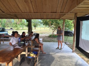
Since this was my first workshop I was as interested in the material as in the participants from Piedras Blancas. The workshop was conducted in Spanish, so at times I had trouble following the presentation and questions, but it was also a great opportunity for me to practice my Spanish.
Amy taught us the basics of GPS and GIS, and then the group enthusiastically began to map. Through different types of activities the participants learned what they could do with a GPS unit and how latitude and longitude locations work with a GPS. Afterwards Amy demonstrated an interactive map and how it can be used to make informed decisions on global and local issues. The group wanted to learn more and so requested a follow-up workshop a few weeks later.
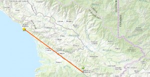
In Bahia Ballena time goes by quickly and it seemed like before I could blink it was already time for our second trip to Piedras Blancas. This time on the drive down I recognized places and landmarks from our previous trip, so the hour drive flew by. One objective for this workshop was to teach the participants how to create their own map using the online mapping tool, ArcGIS Online.

By this time I had created some maps on my own and knew how to work with the program. So I was an active participant, but it was funny for me to try listen and speak in Spanish instead of English. The participants from Piedras Blancas were very interested in learning. The group was tasked with brainstorming different projects that could use GPS maps and these were some ideas:
- Investigating contaminated waters in the high density housing development
- Reforesting areas of the community to bring back wildlife
- Mapping out areas of concentration of trash to demonstrate the need for curb-side trash pickup in the district of Piedras Blandas
- Exploring sustainable agricultural practices
Another workshop will be held the middle of May. I’m working on my Spanish so I can join the conversation even more. I’m also looking forward to the drive because Costa Rica is such a beautiful country and the coast road offers amazing views.


