Standing Room Only: Impact Event San Diego

So to say that the environment was just like Costa Rica, isn’t too far off the mark, thanks to the rain.

The combined weekend total bumped the total July rainfall to 1.7 inches, a new record rainfall for July. The previous wettest July record was in 1902, with 0.92 inches of rain. But this is so little compared to July in Costa Rica, where an estimated 5.5 inches of rain falls in July.

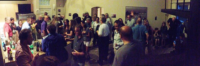
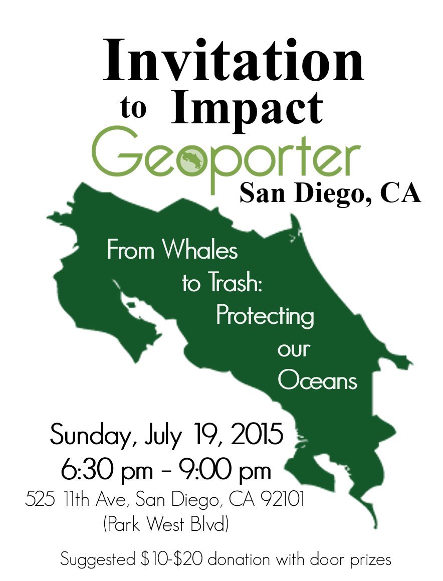
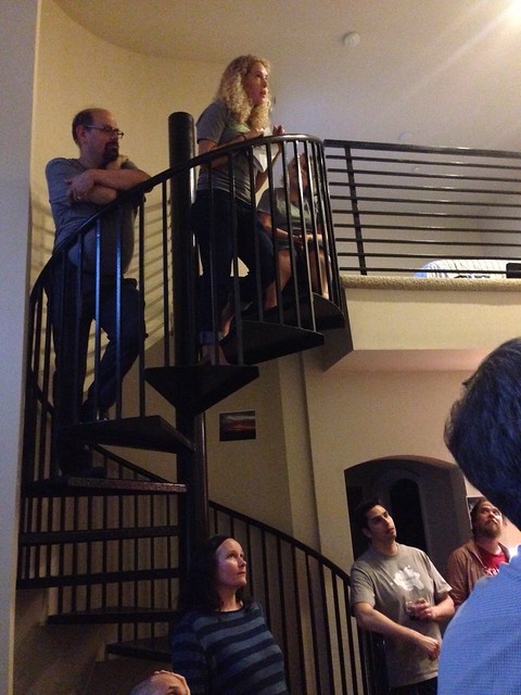
Over 40 people trekked in the rain to make it to the First Geoporter Impact Event. With food and beverages donated from the Boisset Collection, there was standing room only. Roger, Anita and Amy found a little space in a spiral staircase to share the story of Geoporter.

It was wonderful to catch up with so many people who lived in California or who lived elsewhere and spent their evening with Geoporter.

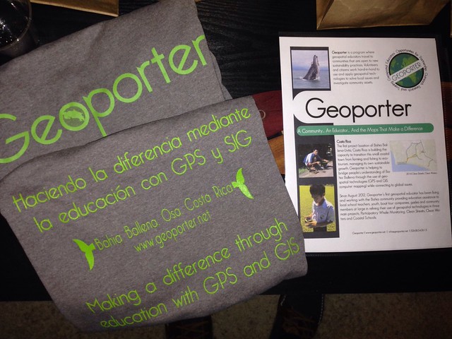
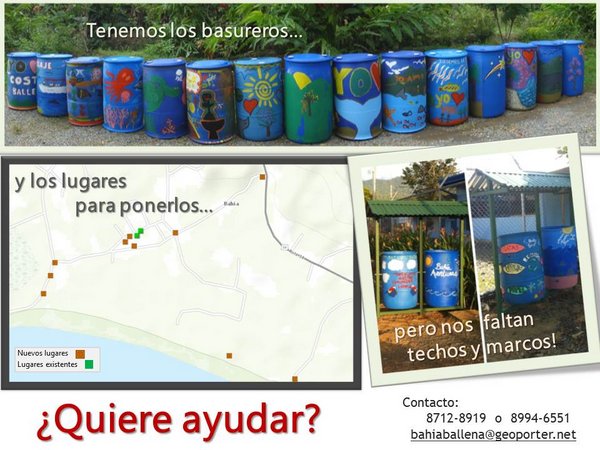
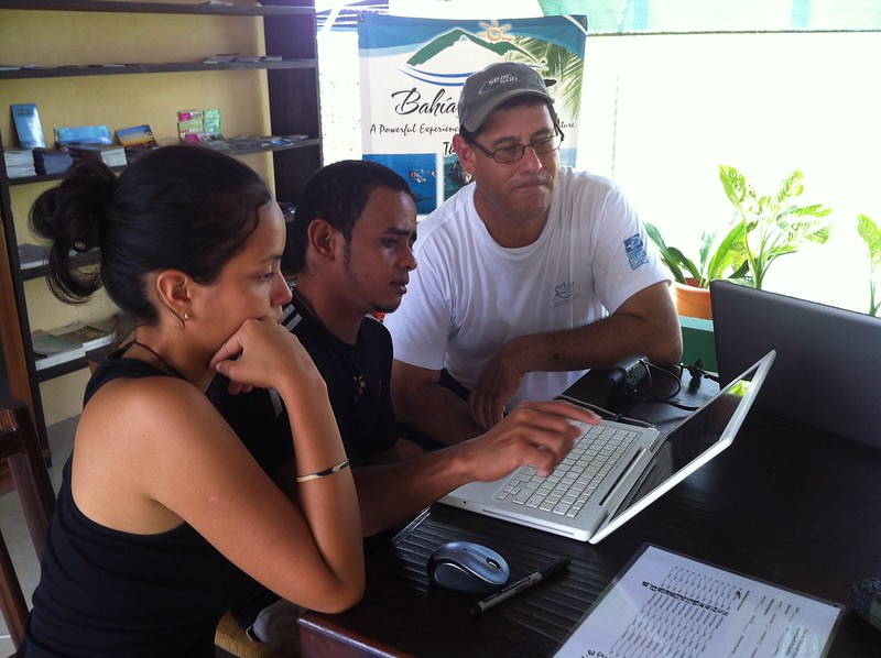
The donations received will help Geoporter make several trips to the nearby Osa Communities to expand on training and will enable several sessions in working with the youth in town. We are extremely grateful for all the kind words we heard and the interest in continuing to support Geoporter.


Impact Event: San Diego, CA

Geoporter will be in San Diego, CA!! We invite you to join the Founders and Director for light appetizers and drinks Sunday, July 19, 2015, from 6:30pm – 9:00pm. Thanks to Boisset Collection for their wine donation.

Geoporter-InviteforImpact-SanDiegoJuly19_2015Come and learn more about our exciting non-profit that uses GIS to inspire community action. Suggested donation: $10-$20. We will have great door prizes from Costa Rica. Don’t miss out. We hope to see you there!

For those attending the EdUC, this will be following the reception and is only a 15-20 minute walk from the Marriott Hotel.

To help us with the amount of food and drinks, we kindly ask those who know they will attend, to send a brief RSVP to let us know how many might be coming. Partners, kids, or others are welcome!

RSVP using this form by July 15. You can also send an email to info@geoporter.net or call / message (214) 533-8376.

525 11th Ave, San Diego, CA 92101
(Use Park West Blvd Entrance)

Directions_SanDiego_ImpactEvent_V2

Sponsors for San Diego Event to Impact:

From Doing to Presenting: Our First Showcase at CACOBA Expo Fair

Geoporter has taken the step towards sharing our work with others in the Costa Ballena Community.  Mid-March, the Chamber of Commerce and Tourism (CACOBA) held an Expo Fair where various tourism companies, local businesses, artists, and projects could share with others their services, products or programs. Geoporter setup a table in the Expo Fair to share our work and make local residents aware of how geospatial technologies (GIS and GPS) are being used by community residents to investigate community resources and problems.

CACOBA Exop Feria - Geoporter with Amy and Luz

Switching from from doing to presenting, we had to organize flyers, printout maps (using a printer that is designed to print out 8.5″ x 11″ and then tape them together), and create a Geoporter sign. With the creativity of Luz, she was able to make our first Geoporter sign. The hand-painted sign will be with us for as long as the cloth material holds up. It’s a priceless piece.

Luz and her creation of our new Geoporter sign


Support through a Smile

If you purchase anything from Amazon, you can now donate 0.5% of the cost of each eligible purchase to Geoporter, at no additional cost to you. Recently, Amazon unveiled Amazon Smile, a simple and automatic way for you to support Geoporter, or your favorite non-profit organization, every time you shop. When you shop at smile.amazon.com, you’ll find the exact same low prices, vast selection, and convenient shopping experience as Amazon.com, with the added bonus that Amazon will donate a portion of the purchase price to Geoporter to help us continue to train and educate community members to use GIS and GPS to map resources and issues impacting their lives.

It’s that easy. Simply go to Amazon Smile and type in “GEOPORTER” as your charity. Then, each time you’re ready to shop, go to Smile.Amazon.com instead of Amazon.com and your donation will be automatically made. You can learn more about Amazon Smile here.

1-SmileWithSeeds

Geoporter appreciates all  your support in helping residents understand their communities through mapping! Happy Smiling!


Connecting to Houston – Mission: Engaging 100+ students with GIS

While Geography Awareness Week doesn’t kick off officially until Monday, November 18, and GIS Day isn’t until next Friday, we kicked it off early. By connecting with one of my colleagues from the first T3G Institute, he helped arrange for this mornings session with over 100 students in grades 9-12 in Houston. The idea: to share how we are using GIS and GPS here in Bahia Ballena. What’s GIS all about? What projects are community members and teachers participating in in a coastal community in Costa Rica?

In addition to myself, I had Fernando, Ronald and Dean connecting with me. This enabled them to see some of the impact with the community members. Pretty cool to have these guys participate with me.

So where did we connect from today?

What’s the distance between Houston and Bahia Ballena?

What a group!!

Bahia-ballena-houston-GIS-Day-2013

Houston Bahia GIS Day 2013

Google+ Hangouts - BahiaBallena GIS Day 2013 - Geoporter

Bahia needs your support – Basura de Bahia

We’ve conducted trash (basura) collections using GPS to map the trash! The containers that will be used for trash and recycling have been purchased and painted by community residents! The community has identified the locations to place the trash cans using the trash maps they created!

All we are missing is the materials to build the roofs and frames to hold two containers together (one for trash and one for recycling) and the roofs to protect the trash and recycling center from filling with water (the holes have already been punched in the containers to let water escape).

BAHIA TRASH PROJECT

Today a letter was sent out to businesses and community residents about the seeking support for acquiring the funds to make these basureros happen.

To date, the Geoporter Team working on this project consists of many companies and many individuals have volunteered their time and already contributed resources. What an incredible community. If you are interested in helping, contact us and we’ll send you the information to this project.

 —————————————

Dear friends of the community,

We all love our community and its natural resources. For that we are working hard to conserve our natural resources via trash collections and mapping, and subsequently the construction of trash centers, which are being strategically placed in the community of Bahia as you can see in the map.

Would you like to help?  If so, you can contribute via wire transfer to the accounts of El Colono La Jungla.  Please put in the detail/comments section: “BAHIA TRASH PROJECT”.  The materials cost to build the roof and frame for one trash center is 46,000 colones (Approx. $92 USD).  Please note that we have the trash cans ready and painted!

Please contact us for the account of El Colono La Jungla:

** The Muni will collect the trash
** We would like to place these before October 31

Gracias,
Team Geoporter
EquipoGeoporterBasura

The best gift of all is sharing with others

One of the objectives of the Geoporter project is to share our knowledge of geospatial technologies, GIS, GPS and remote sensing, with others. But ultimately what we hope to achieve is that by sharing our knowledge with others, others will acquire the skills to not only use GPS they will have the skills and knowledge to share what they’ve learned with others. And so the sharing begins…. 

Every week, we have weekly meetings with the tour guides to learn more about GPS, how to use the data collection sheet that was developed in conjunction with the tour guides and Fundacion KETO, and transfer the data to the computers to map it. Recently new guides have started to attend the trainings, and others already using GPS have started sharing what they know with those who are new. 

The first week in December, the president of the Asociacion de Guias de Bahia Ballena (ASOGUIBA) and one of the key partners in the Ballenas project, Fernando Guerrero invited the president and treasurer from the Asociacion Guias Turisticas Piedras Blancas, in Piedras Blancas National Park. Bruss and Rocio came to our evening meeting where Fernando explained GPS to them and had them practice using GPS in the street. Ronald explained the project and showed how they are using ArcGIS Online to record whale sightings in Marino Ballena National Park and the trash map that is being used to assess the location of new public trash cans.

The following day, Bruss and Rocio explored a bit of Bahia Ballena with Luz and Fernando using GPS units from the project. They then returned to Bahia Aventuras to download their points and create their own map. They were excited to see the result and were discussing ideas they would like to explore in Piedres Blancas and how to recieve additional training using GPS and GIS. 

It was wonderful to see the sharing of knowledge of using GPS to collect data points and then transferring them on a map. And what’s better is that the residents of Bahia Ballena were teaching others. I think a transition has begun…