The Pura Vida of The Pollination Project: The Impact of $1K in Costa Rica

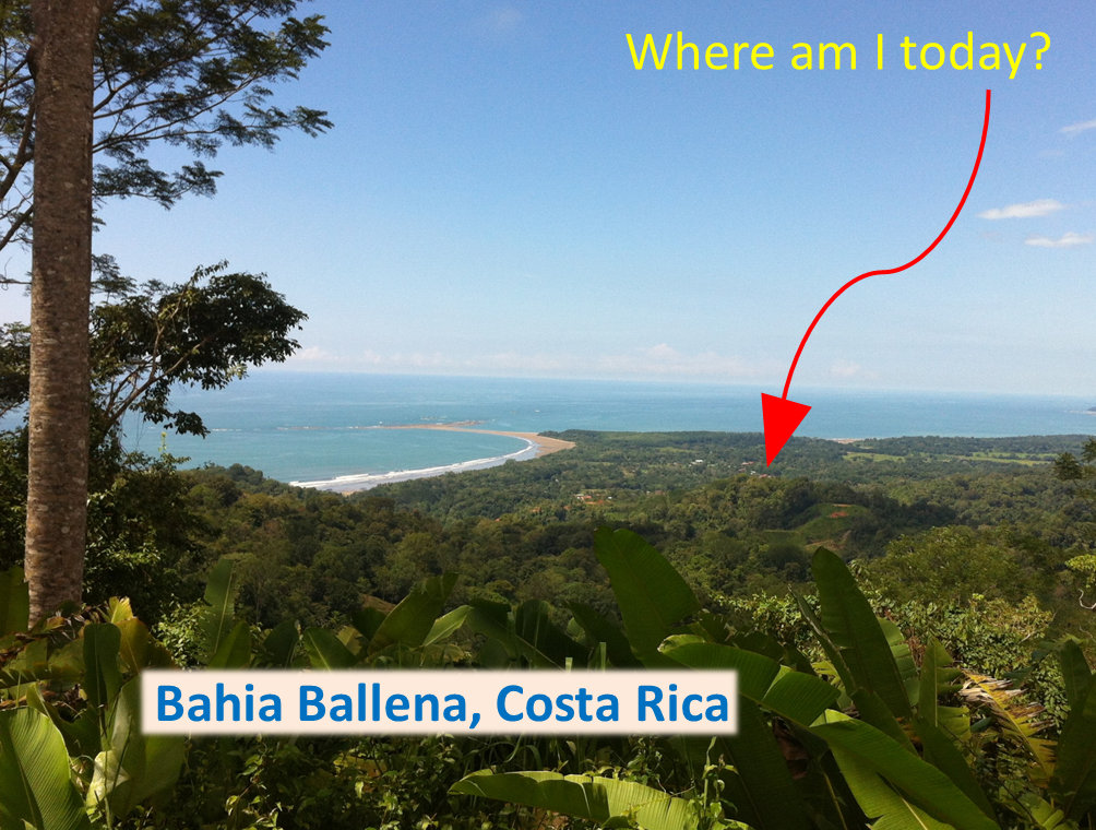
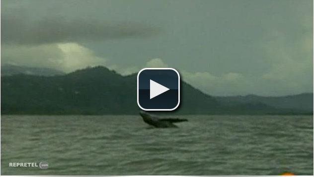
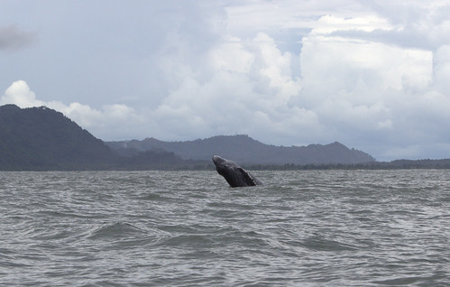
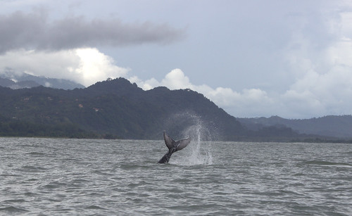
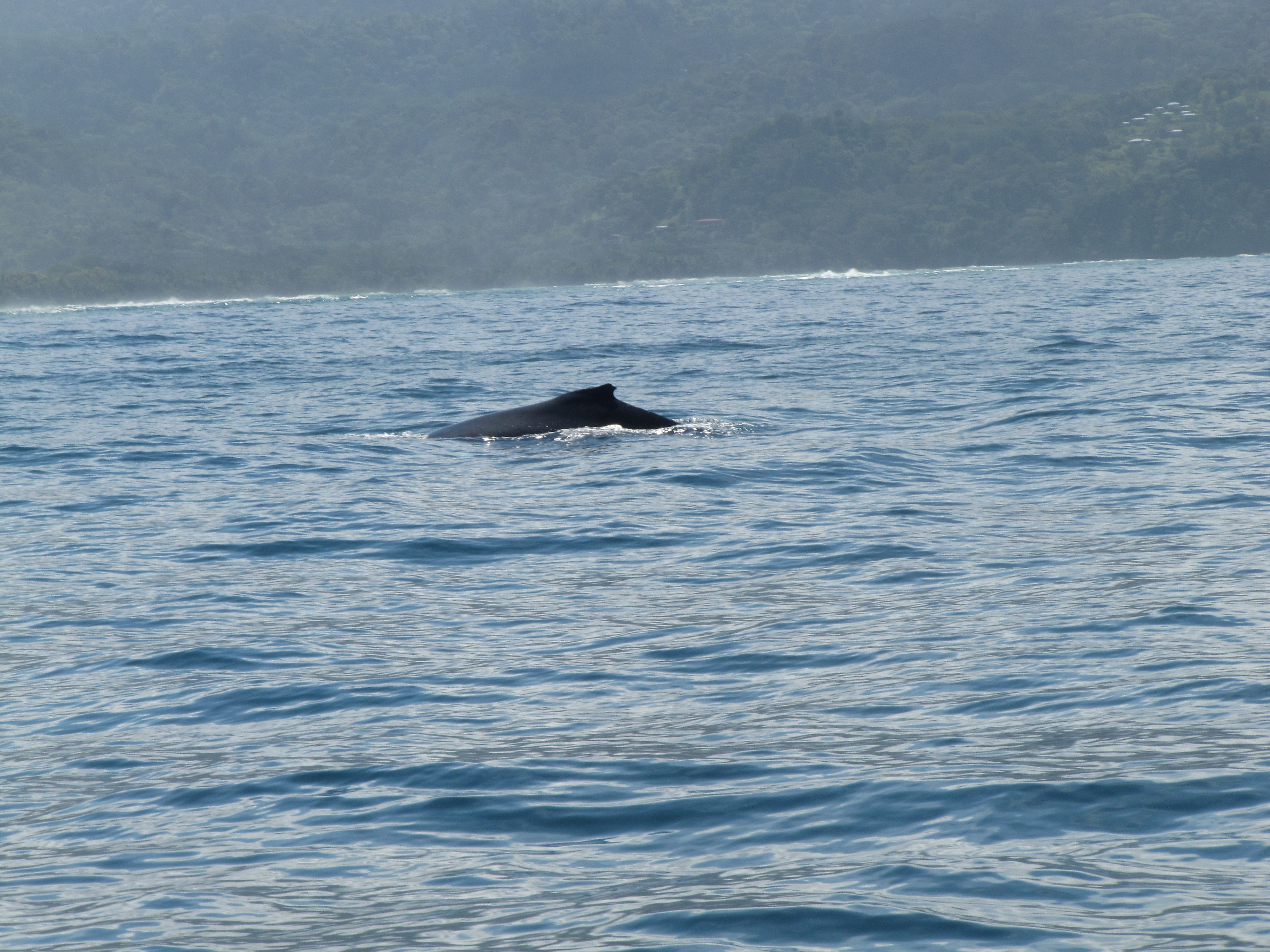
Humpback whales from northern and southern migrations in the Pacific Ocean travel every winter to the breeding grounds near the equator. These humpback whales now have a breeding environment off the coast of Costa Rica that is less polluted than it was a year ago, before The Pollination Project seeded Bahia Ballena.

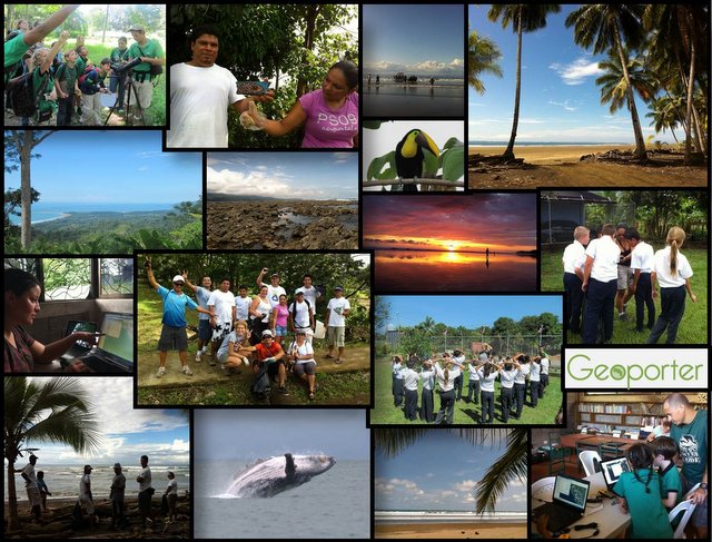
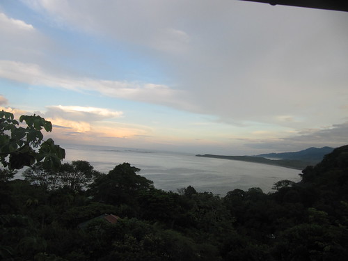
Bahia Ballena is a small coastal community with 3,000+ residents that has transitioned from a rural fishing village to one that brings in more than 20,000 tourists annually to see these magnificent creatures in their natural breeding grounds. Over the past year, residents of Bahia Ballena have been using GPS units and computers with GIS (computer mapping and analysis software), that were purchased with support from The Pollination Project, to improve the environment of their community and the habitat of the whales that call the ocean waters home for about four months every year.

Basureros-bahiaballena-costarica-geoporter

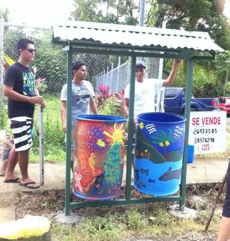
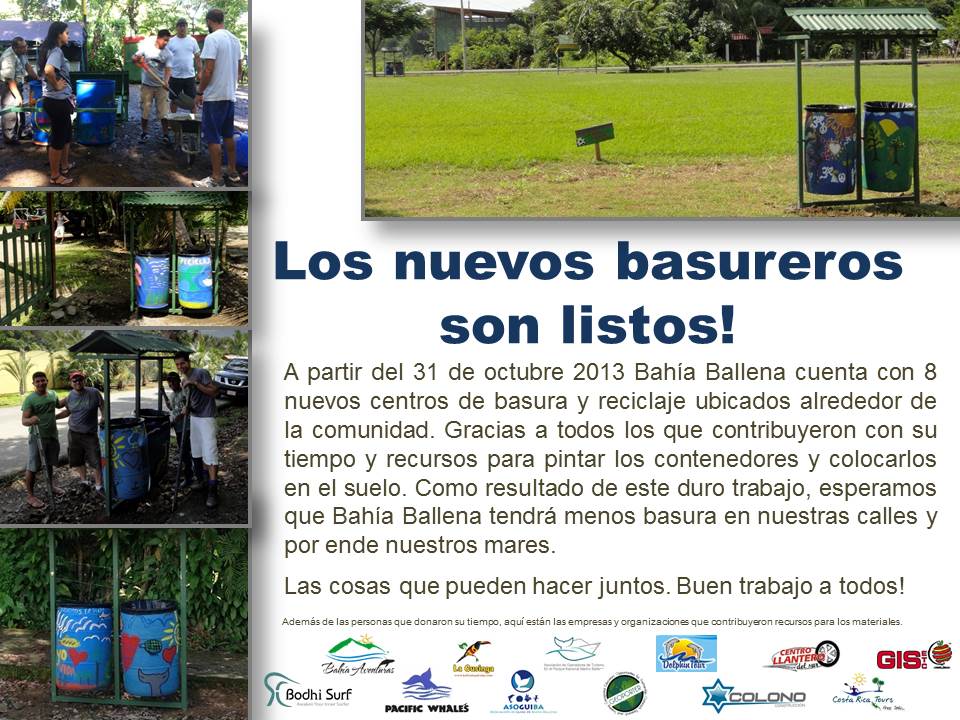
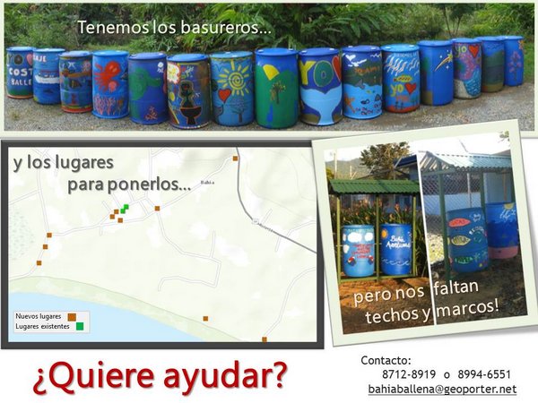
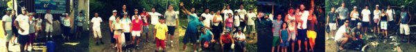
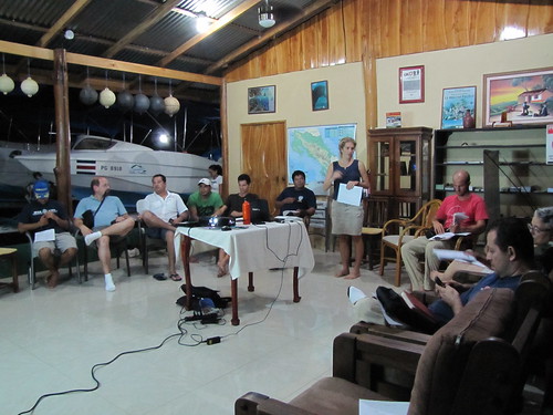
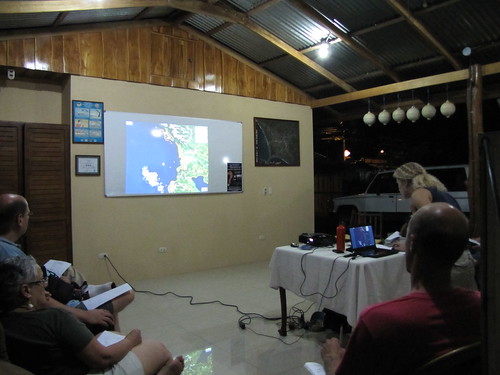
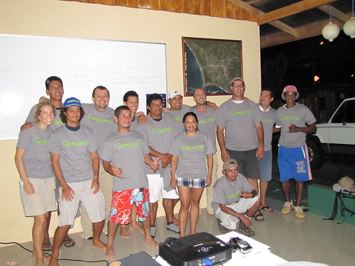
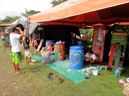
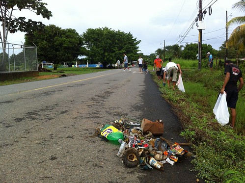
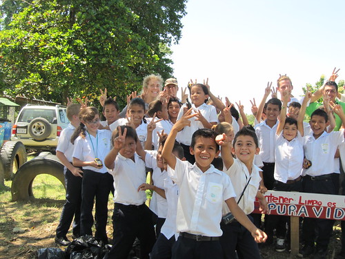
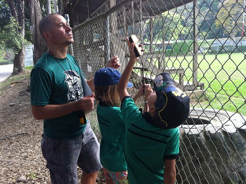
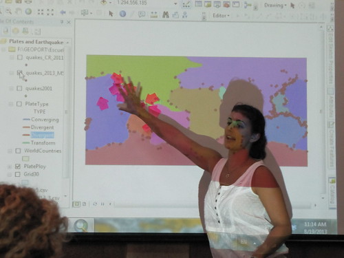
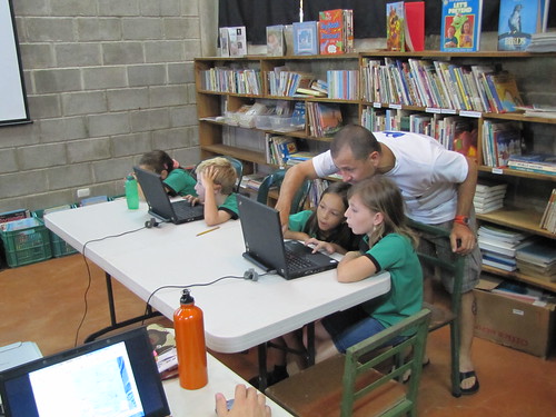
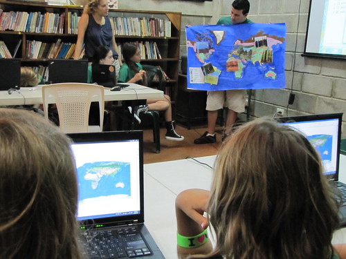
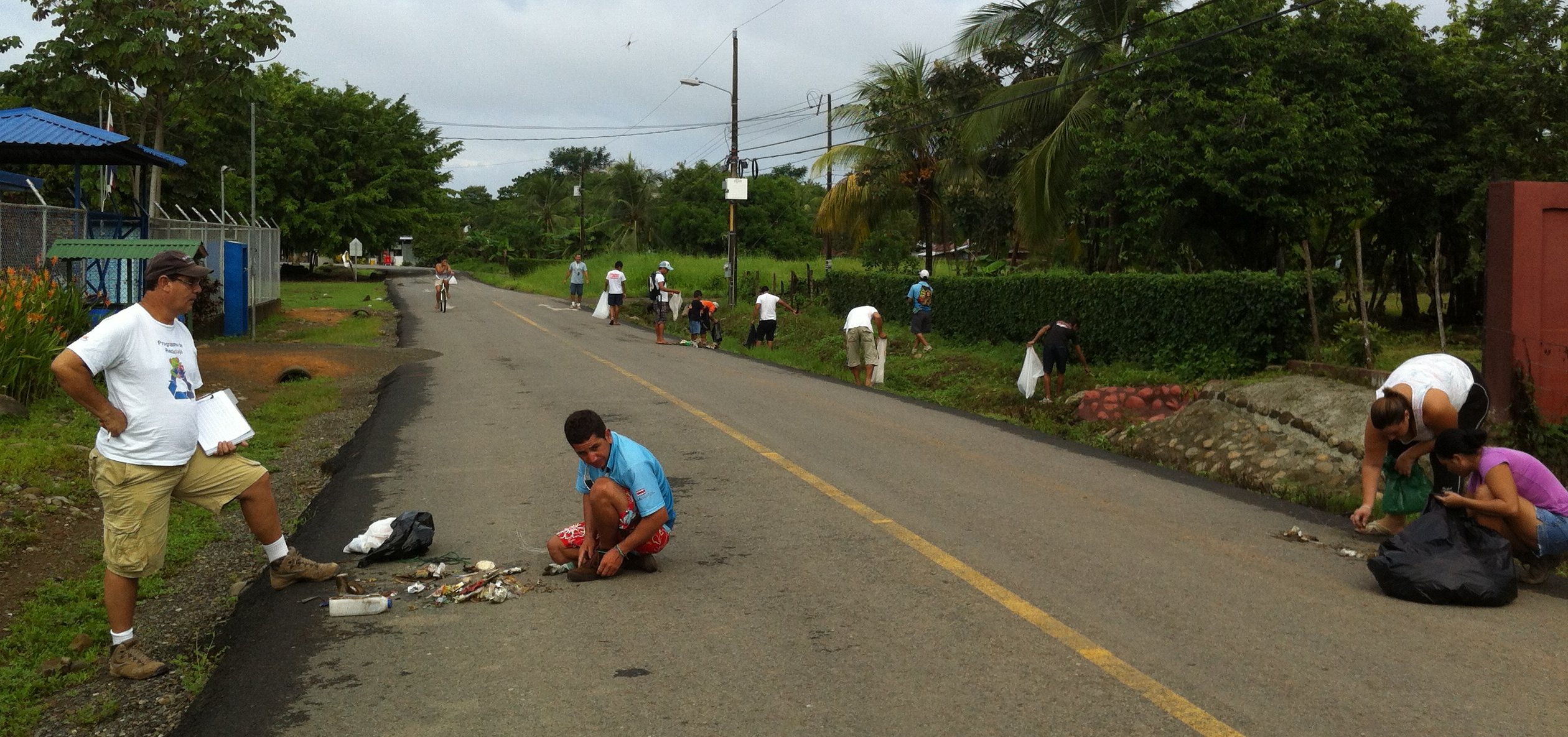
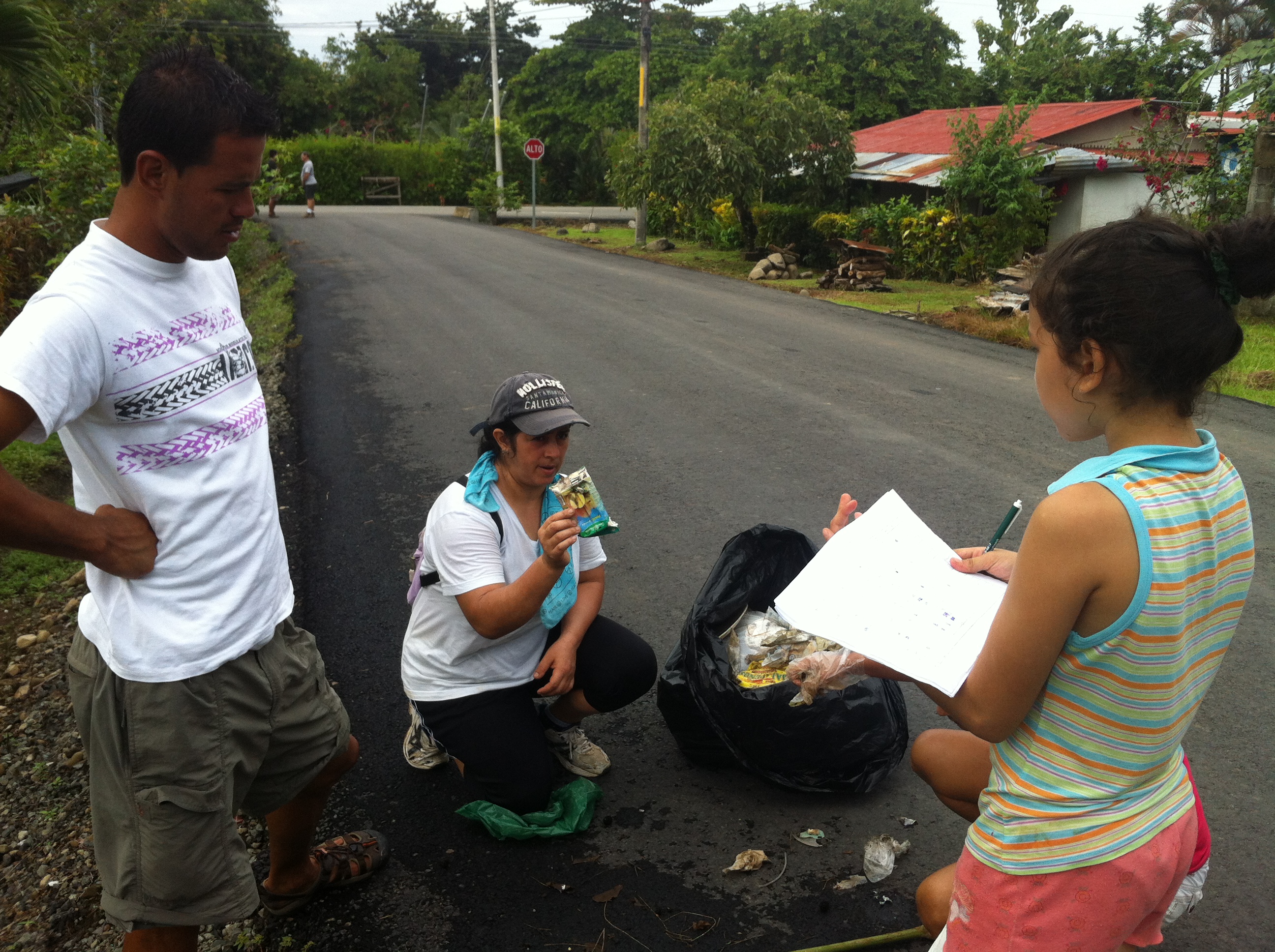
This geospatial travel lab of four GPS units, rechargeable batteries and two computers has enabled Geoporter to train and educate community members to use these technologies to investigate their community. Over five months residents, including youth, categorized and mapped trash along the streets and beaches in town. After the 6 am Friday morning trash classification activities, key residents and leaders gathered to review the trash maps, created by residents, to examine concentrations of trash and identify new locations to place trash and recycling containers. By going door to door, residents collected enough money from ten companies and organizations in town to build and construct eight new trash and recycling centers with roofs to protect from the daily rains.

geoporter-laflor-basura
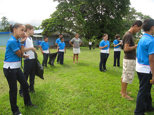
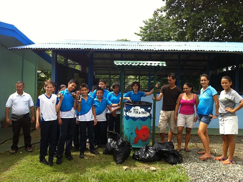
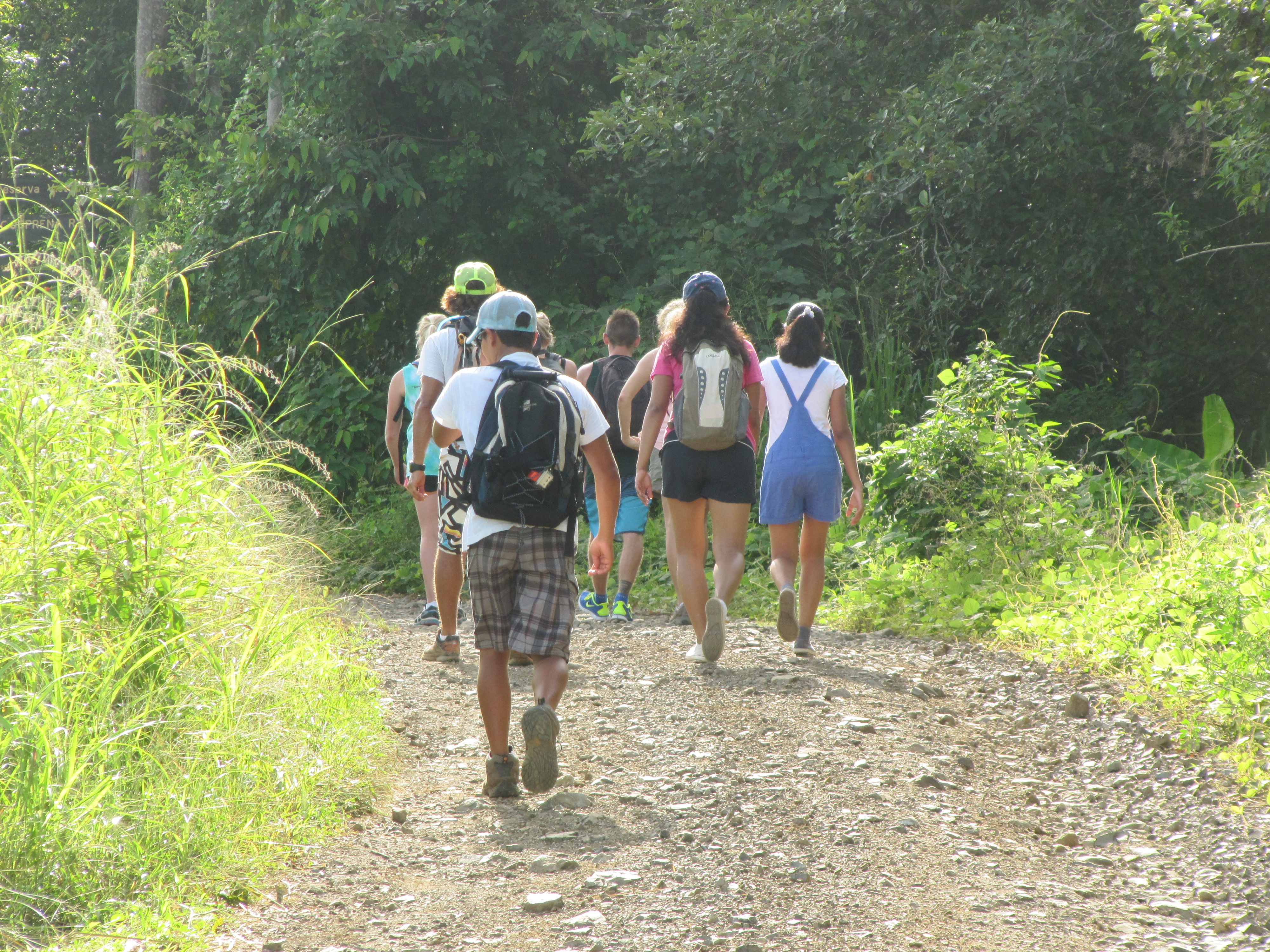
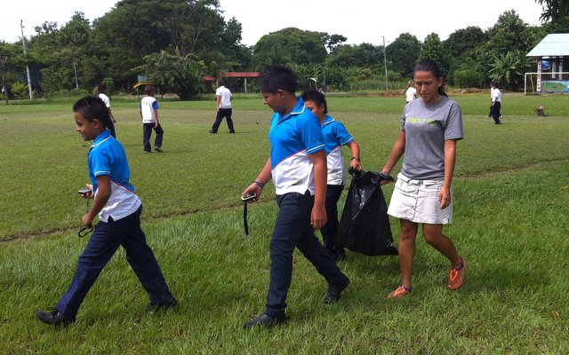
Residents know that placing these trash cans is not the final solution to eliminating trash in the streets and beaches and protecting the marine habitat, but rather there needs to be a behavioral shift in the people. With this in mind, residents and the resident Geoporter in town shared the GPS and GIS technologies with students in the local elementary school. Students learned how to use the technologies while also understanding their role in creating and eliminating trash in the streets. Using the trash map created from data collected by the students, the director of the school was recently informed that the school earned its first Blue Flag as part of the Bandera Azul program. Bandera Azul is a national program designed to recognize schools, communities, organizations that develop and implement environmentally friendly practices by balancing conservation, development and protection of natural resources.

With the new trash and recycling centers placed in the ground at the end of October, residents are now preparing for another high season of tourists and mapping the streets and beaches again to see if the new trash centers have made an impact in the amount of debris in the streets. With over 128 cm (50 in) of annual rainfall, it doesn’t take long for the trash in the streets to make the 2 km journey to the ocean and the winter breading grounds of humpback whales in Marino Ballena National Park. But trash isn’t the only thing residents are concerned about. ballenas-geoporter-jovino-bahiaballena-
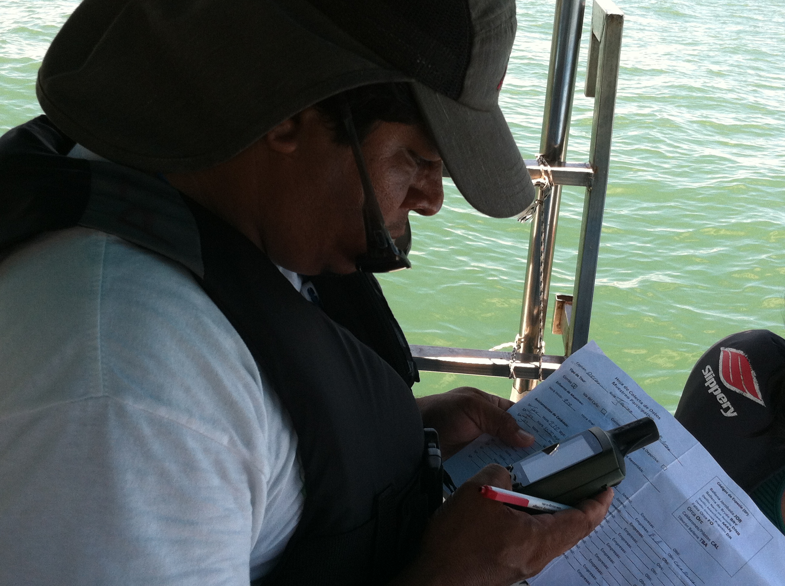
They also want to know when the whales are arriving, where they can be spotted in the ocean and the departure dates so they can help protect the whales and their habitat. Guides and captains from different Tour Companies are using these technologies to map the daily humpback whale sightings during the different migration seasons which will help them understand the whale patterns today as well to see changes in whale numbers, location, and arrival and departure dates in the future.

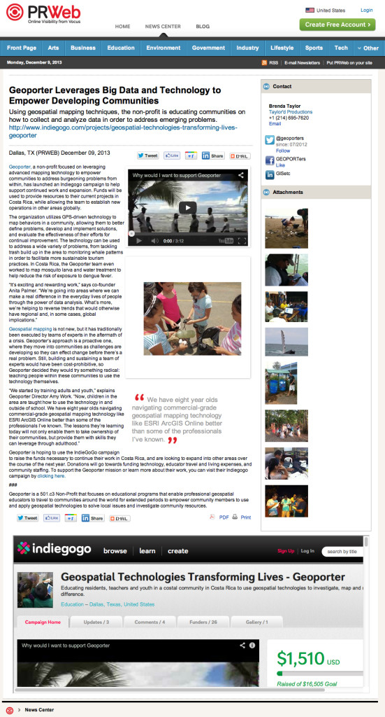
Without the support of The Pollination Project, Geoporter would have been without the geospatial travel lab to take to different locations to train and educate community members to apply the technologies and carry out projects themselves. The application of these technologies has earned national news recognition with two articles being published in La Nación, one of the national newspapers in Costa Rica, about residents using GPS and GIS in to map trash and monitor whales. Residents of Bahia Ballena along with Geoporter are grateful for this support and have had the opportunity to take this travel lab to other nearby communities to share ideas and help support other communities to start learning how to use GPS and GIS. With these seed funds, Geoporter applied for and recently received its 501(c)3 status in the U.S. to continue educating communities around the world to learn to use these technologies for themselves to investigate their community and make the change they wish to see in the world. Thank you for pollinating our project and helping us get started on our dream to change the world through education with GIS and GPS!

We currently have an IndieGoGo Project to help raise funds to continue this project. Won’t you help us continue to make a difference.


On your mark, get set…..Snap!

Yep, you’ve got it. For more than a year now we’ve managed to build a collection of thousands of photos. We are going through these photos to find a few of our favorite photos (this is going to be really, really, really hard) and we want to share these photos with you or someone special.

So here’s the deal:  We know you have many special people in your life. So just find one and when you DONATE ANY AMOUNT you wish to our FUNDRAISING CAMPAIGN (you have until December 28) and we will send a digital holiday card to this special person wishing them a Happy New Year. The holiday card will share some of our favorite moments since we’ve been down here. While all you have to do is identify a person (or people and donate a few different times), your gift will keep on giving! If you have several people you can make a few donations in their name. Your contribution will continue to help Geoporter make a difference educating community residents here in Bahia Ballena and other new communities, how to use geospatial mapping technologies.

Here’s a quick look at just a few of our favorite photos. But I must tell you, we have thousands!
HolidayCard2013_v1-640

We have eight new trash and recycling centers!!

With a little creativity along the way, a lot of hard work by many, many individuals in town, what was one a vision has become a reality. Recently, Geoporter in conjunction with eleven other companies constructed, painted, and placed eight new trash and recycling centers in town. Next year around this time, we will have mapped the trash again to see if these containers are helping to make a difference in the trash problem in town. Thanks to all those who participated!!

basureros-bahia-ballena

Connecting to Houston – Mission: Engaging 100+ students with GIS

While Geography Awareness Week doesn’t kick off officially until Monday, November 18, and GIS Day isn’t until next Friday, we kicked it off early. By connecting with one of my colleagues from the first T3G Institute, he helped arrange for this mornings session with over 100 students in grades 9-12 in Houston. The idea: to share how we are using GIS and GPS here in Bahia Ballena. What’s GIS all about? What projects are community members and teachers participating in in a coastal community in Costa Rica?

In addition to myself, I had Fernando, Ronald and Dean connecting with me. This enabled them to see some of the impact with the community members. Pretty cool to have these guys participate with me.

So where did we connect from today?

What’s the distance between Houston and Bahia Ballena?

What a group!!

Bahia-ballena-houston-GIS-Day-2013

Houston Bahia GIS Day 2013

Google+ Hangouts - BahiaBallena GIS Day 2013 - Geoporter

Bahia needs your support – Basura de Bahia

We’ve conducted trash (basura) collections using GPS to map the trash! The containers that will be used for trash and recycling have been purchased and painted by community residents! The community has identified the locations to place the trash cans using the trash maps they created!

All we are missing is the materials to build the roofs and frames to hold two containers together (one for trash and one for recycling) and the roofs to protect the trash and recycling center from filling with water (the holes have already been punched in the containers to let water escape).

BAHIA TRASH PROJECT

Today a letter was sent out to businesses and community residents about the seeking support for acquiring the funds to make these basureros happen.

To date, the Geoporter Team working on this project consists of many companies and many individuals have volunteered their time and already contributed resources. What an incredible community. If you are interested in helping, contact us and we’ll send you the information to this project.

 —————————————

Dear friends of the community,

We all love our community and its natural resources. For that we are working hard to conserve our natural resources via trash collections and mapping, and subsequently the construction of trash centers, which are being strategically placed in the community of Bahia as you can see in the map.

Would you like to help?  If so, you can contribute via wire transfer to the accounts of El Colono La Jungla.  Please put in the detail/comments section: “BAHIA TRASH PROJECT”.  The materials cost to build the roof and frame for one trash center is 46,000 colones (Approx. $92 USD).  Please note that we have the trash cans ready and painted!

Please contact us for the account of El Colono La Jungla:

** The Muni will collect the trash
** We would like to place these before October 31

Gracias,
Team Geoporter
EquipoGeoporterBasura

Monitoring Whales on National TV in Costa Rica

The Festival of Whales and Dolphins brings many people here to Bahia Ballena for two weekends in September, including many TV stations. This year, our second year here for the Festival, we connected with Repretel, a national Costa Rica news station. After watching the President of Costa Rica, Laura Chinchilla, speak at the opening festivities, we were connected with Repretel through individuals from MarViva, with whom we’ve met with before and explained the Geoporter projects.
Repretel asked to see how the GPS units were being used to monitor the whales in Marino Ballena National Park. We were send Repretel out with Bahia Aventuras and their guides and captains Reymer, Cristian, and Marlon, to show them the process of recording the whale sightings with GPS.
While the seas were a bit rough for capturing video, here is the report that was broadcast on Repretel, Channel 11 this past Wednesday, the 12th of September.
Repetel Geoporter Video

We’re Celebrating!!! We are Officially One! A Year as Geoporter in Bahia Ballena, Costa Rica

August 7, 2012, I was making my way to Bahia Ballena to spend 2 months training residents, youth and teachers how to use GIS and GPS to map the whale sightings, trash in the community and use in the classrooms. Here we are 12 months later celebrating our first year as Geoporter and 1 full year in Bahia Ballena. What a year it has been.

Geoporter Year 1 - Costa Rica Visit

I had the opportunity to spend the 1-year anniversary with two of the co-founders, Anita and Roger Palmer from GISetc and a project supporter here in Bahia Ballena alongside all the community partners. What did we do? We held a community advisory meeting to assess our current progress and chart out where we want to go. We created commissions and assigned individuals to assist with various projects. We celebrated with “arroz con pollo”…and with new t-shirts that were generously donated to the project.

Geoporter 1 -Year activities

Geoporter 1 -Year activities

Geoporter Year 1 - Costa Rica Visit

Geoporter Year 1 - Costa Rica Visit

Geoporter 1 -Year activities

It’s incredible to think how far we have come over the course of one year. But as we review this, there is still so much to do. New projects continue to develop and evolve weekly. For example, a new project is recording the locations of dead animals along the Costanera between Dominical and Playa Tortuga. We have also had success in placing new trash-cans around the community along with painting new trash cans to place in new locations identified using the trash map generated by the community. We have a separate trash-committee that is working to take steps towards preventing trash from entering the streets of Bahia, which will ultimately reduce the amount of trash we see in our oceans.

View Larger Map

BodhiSurf-trashcanPainting2

We have also connected with the elementary school here in town, Escuela la Flor de Bahia, to work with the teachers and students on mapping trash. Once a week a group of five community members heads to the school to use GPS to map and record the trash around the school and soccer field. It’s incredible to see how quickly the students are picking up on the GPS technology and racing to mark the next piece of trash. This trash mapping supports one of the activities the school has identified for their participation in the Bandera Azul program.

Recoleccion de Basura - Bahia Ballena - Escuela

La Flor de Bahia - GPS con grado 6
2013-08-30 09.39.45

La Flor de Bahia - GPS con Grados 4 y 2

At Escuela Verde, there are four teachers using GIS and GPS with their students. They are using the technologies to understand soil types, boundary limits of their community, doing math geocaching, exploring ancient civilizations such at the Egyptians, Mayans or Nazcas, or understanding what causes earthquakes and where they occur (outside of Costa Rica). The students, ranging from grades 2-6, are now asking, “when’s the next time we get to use GIS again Miss. Amy.”

2013-04-16 09.22.54

Geoporter 1 -Year activities

Geoporter 1 -Year activities

Geoporter 1 -Year activities
Currently we are in the middle of the 5th Festival of Whales and Dolphins, which brings people from all over the world to celebrate the Southern Humpback whales that call Marino Ballena Park home for approximately 5 months of the year. The 8 guides and captains and 3 companies participating weekly in this season’s monitoring, are busy taking guests out to the park to see the whales jumping. The whales are plentiful and at times the boats will see 8 whales. The most exciting news was seeing orca’s near Isla Cano and 4 male humpback whales jumping trying to gain the attention of a female humpback whale. And of course seeing the humpback whales jumping out of the water and showing us their tales (which are both white and black from the southern migrations).

Ballenas del Festival de Ballenas y Delfines - 2013

View Larger Map

Ballenas del Festival de Ballenas y Delfines - 2013

What a year it has been and we are excited to venture into this next year of Geoporter!

Shifting from Trash Collections to Taking Action! What can we do to prevent trash from entering our streets?

Since April, various individuals from Bahía-Uvita have been working together to understand a serious problem that impacts communities around the world: Trash. Every Friday, starting the first week in April, individuals have gathered to pick up trash from the streets. Each week a new location is selected for the cleanup. But, this isn’t just any ordinary community trash collection. Residents are using GPS technology to record the location of the trash they collect and then using GIS (Geographic Information Systems) to create maps that show the amount of trash and type of trash collected.

basura-recoleccion-bahia-ballena-geoporter

basura-recoleccion-gps-classification-geoporter-bahia-ballena-uvita-costa-rica

The approach residents selected to map the trash is: to count and classify the type of trash in a 24m radius along the streets and beaches. The resulting trash map shows the areas that have the greatest amount of trash.

Basura-map-trash-GPS-GIS-Geoporter-bahiaballena-costarica

As a community, we could continue to collect trash every Friday for the rest of our lives. But that is not the answer to the trash problem. Rather, we have to take action to prevent trash from entering our streets in the first place. Using the trash map, we as a community have identified where new public trashcans (checkered flags on map), to use for both trash and recyclables, need to be placed. The community is working now to gather the resources and materials to construct trashcans to place in the identified locations.

ubicacions-basureros-nuevos-bahia-ballena-geoporter

The Asociación de Desarrollo Integral de Uvita recently constructed 4 trash cans to place in Bahia-Uvita. These are in addition to the trash and recycling cans sponsored by Bodhi Surf School and Bahía Aventuras (green flags on map) in January and the materials that others such as the Asociación de Guías and the Asociación de Operadores de Turismo y individual businesses are looking to also provide.

basureros-uvita-asociación de-desarrollo-integral-de-uvita-geoporter

basureros-jaunary-bodhi-surf-bahia-aventuras-bahia-ballena-geoporter

Placing trashcans in public locations is not the only solution to eliminating trash. Education and outreach are also important for understanding what we can do today as well as how our actions today can impact the future. The last two Fridays Geoporter has switched from trash collections to discussions about what actions can we take to reach out to students, community members, businesses and tourists who visit our community. The ideas generated from the first meeting were plentiful and impressive, but not the final list. The list will continue to grow as others submit ideas and choose to take responsibility for helping to implement the actions that will benefit the community.

Basura-ideas-bahiaballena-geoporter

During this last meeting, the group highlighted the most important items to carry out as a community and what each person would be willing to commit to doing. Thus for future Fridays individuals will work on items they commit to and report back. We invite all those interested in assisting to join our meetings and conversations and to share new ideas and commit to an action(s) that is important to them.

Perspectives of my first week volunteering with Geoporter

I arrived in the beautiful town of Bahía Ballena a week ago, and have witnessed Geoporter work in full swing. This week, I focused on trash and whale monitoring.  However, it is clear that there is potential for GPS and Geoporter analysis in many corners of Bahía Ballena.

One the trash front, we collected between the two BM supermarkets early on Friday morning. We had a great crew with us, and were able to collect along the entire stretch in two hours. As expected, we collected mainly plastic items, many of which were related to food. I began analysis of the previous data, searching for trends and points to improve upon. I found that: A) the red zones for trash are in the school zone, along the highway, and near the bars and restaurants; B) most of the trash collected is actually recyclable; and C) most of the trash is related to food or drink consumption. With this in mind, we can make recommendations for steps forward to mitigate the trash problem here in the community.

Trash Collection Costanera

One of the main points that we wish to stress is the connection between trash and beauty. Less trash would mean a clean beach with healthier animals. Less trash on the ground means less people are likely to litter, leading to a more beautiful landscape. I was particularly inspired by how some community members have taken it into their own hands to actively turn the trash in to beautiful projects: the plastic bottle basureros and Luz’s jewelry. Projects like these exemplify a cultural shift in the community’s relationships with waste.

2013-07-12 14.50.16

This week we had a meeting with the association of guides in Bahía Ballena.  We practiced using new and more durable whale monitoring sheets. The new ones can withstand the winds and wetness that often accompany boat tours. I was lucky enough to go out on a combo tour with Bahía Aventuras where I saw the new sheets in action.  Plenty of whales and dolphins, too!

marino-ballena-national-park-costa-rica-geoporter-whales

I keep coming across different potential uses for GPS and geospatial technologies in Bahía Ballena.  For instance, today I went on a hike and learned that trails are relatively unmarked and unmapped. Maps made possible by GPS could open the doors to a new sector of tours branching from Bahía. We saw plenty of wildlife on the hike: sloths, monkeys, butterflies, and frogs. All these animals could be mapped, just like the whales.  This could open the doors towards a more developed guided hike business in the community.

mtn-hike-bahia-ballena-geoporter

Amy, Fernando, and I drove up to Hacienda Baru, a National Wildlife Refuge and Lodge, to give a presentation about the potential of GPS and GIS in their reserve. They were interested in using it for tracking turtle locations, animals and trees. The possibilities seem broad, and they were excited to get going in the learning process. We plan on returning later for further trainings.

Some next steps forward for Geoporter are to continue to train community members in using our technologies and making sure that whatever data is collected is put to a practical use.

More later!
Maggy